
Cleopatra Mountain & the North Fork Smith River Watershed: A wonderland of geology & botany
Written by Michael Dotson in October 2025
There are a couple of ways to make it into Cleopatra Mountain from major highways. The Gasquet Mountain Road is a more direct route from the California side, which is located off Highway 101 near the town of Gasquet. If you’re in Brookings, OR, you can also go in via the High Divide Route near Rowdy Creek and/or the small community of Smith River (off Highway 101). Photo credit: Vimal Golding
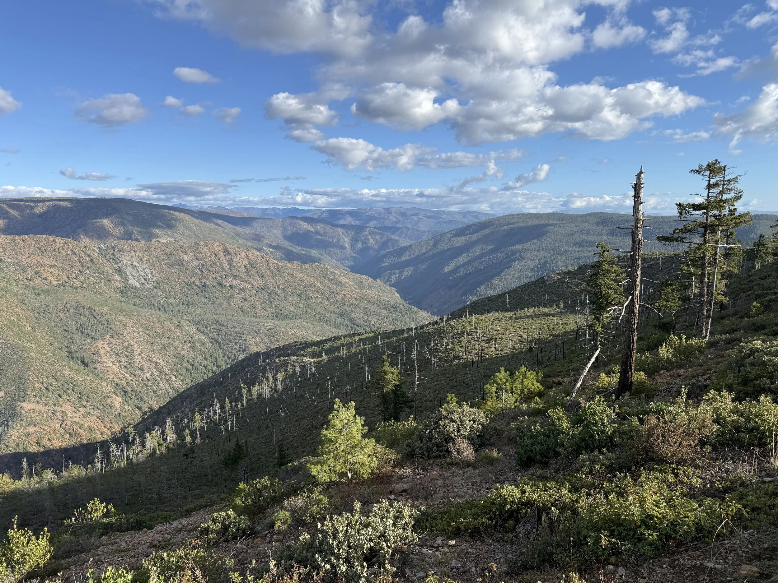
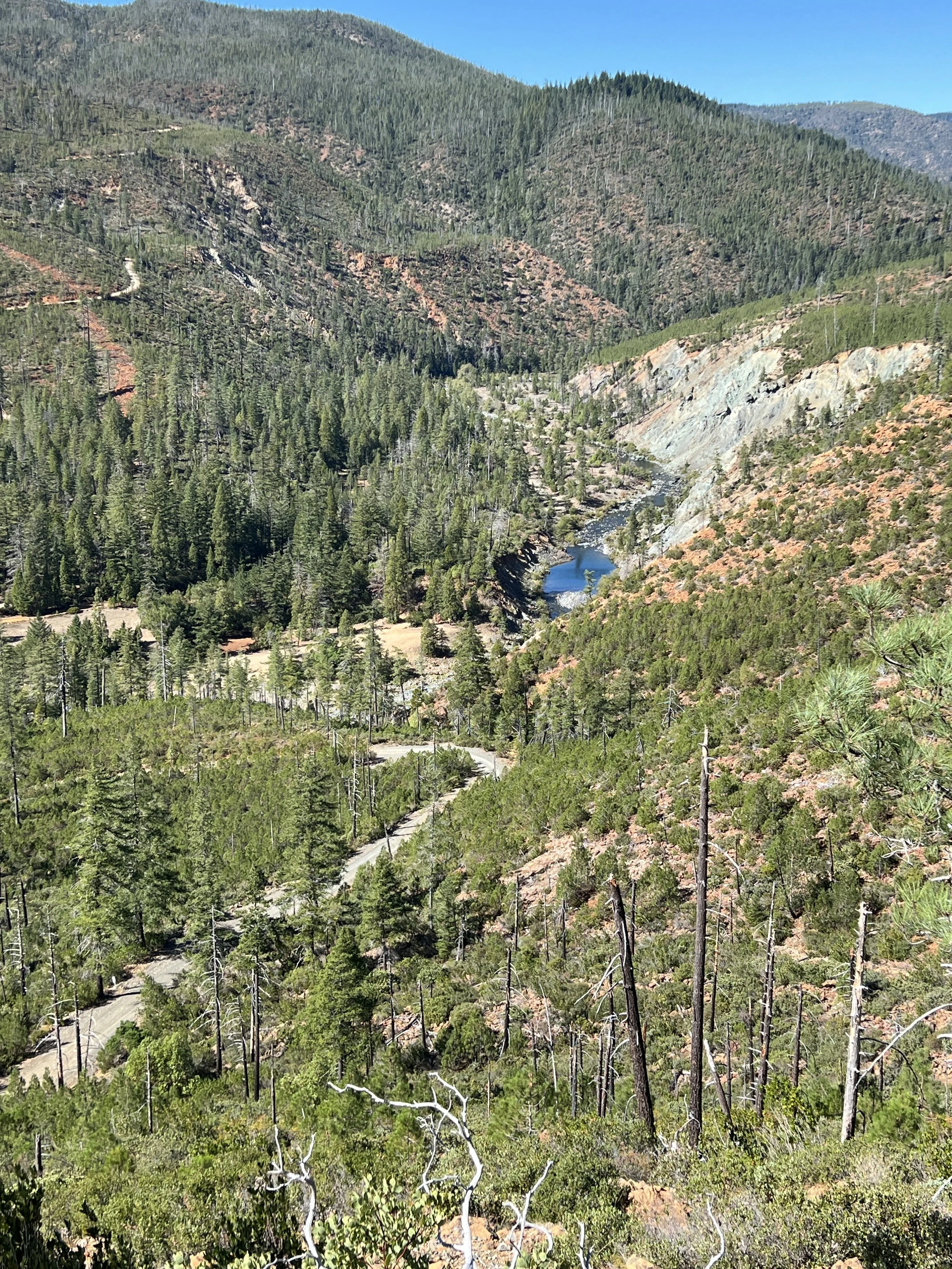
We hiked from a road junction several miles above the North Fork Smith River. We started our hike in California, and within a mile or so, we crossed into Oregon by foot. Here we are looking north into the headwaters of the North Fork Smith River, which is forms the western boundary of the Kalmiopsis Wilderness. Photo credit: Michael Dotson
On a beautiful autumn day, I set out for Cleopatra Mountain with some friends and colleagues. Our destination is part of a series of high plateaus that rise sharply from the North Fork Smith River, which is a beautiful emerald-green ribbon of water that cuts through the Josephine Ophiolite in southwestern Oregon and northwestern California. For fans of whitewater paddling, this stretch of water is world-renowned for its rapids, waterfalls, and remote nature. For geologists, this part of the world is just one of a few places where the Earth’s oceanic crust uplifts and becomes exposed on the surface. It’s a visually stunning landscape that has long been shaped by water and wildfire.
Our hike began at the very tippy-top of California in Del Norte County, about 15 miles from where the Redwood forests peter out inland from the Pacific Coast. Within a half hour of leaving our vehicles, we stepped foot into Oregon. The North Fork Smith River and surrounding landscape in California is fairly protected from development as part of the Smith River National Recreation Area; but once you’re in Oregon, the landscape does not have the same level of protections. That’s a big reason why mining corporations have been eying this landscape for several decades: they see the potential for large-scale nickel mines.
We made the overland journey to Cleopatra Mountain by 4-wheel drive and by foot over the course of a couple of days. Our goal was to document the landscape and to learn about emerging threats to this watershed and its unique botanical diversity.
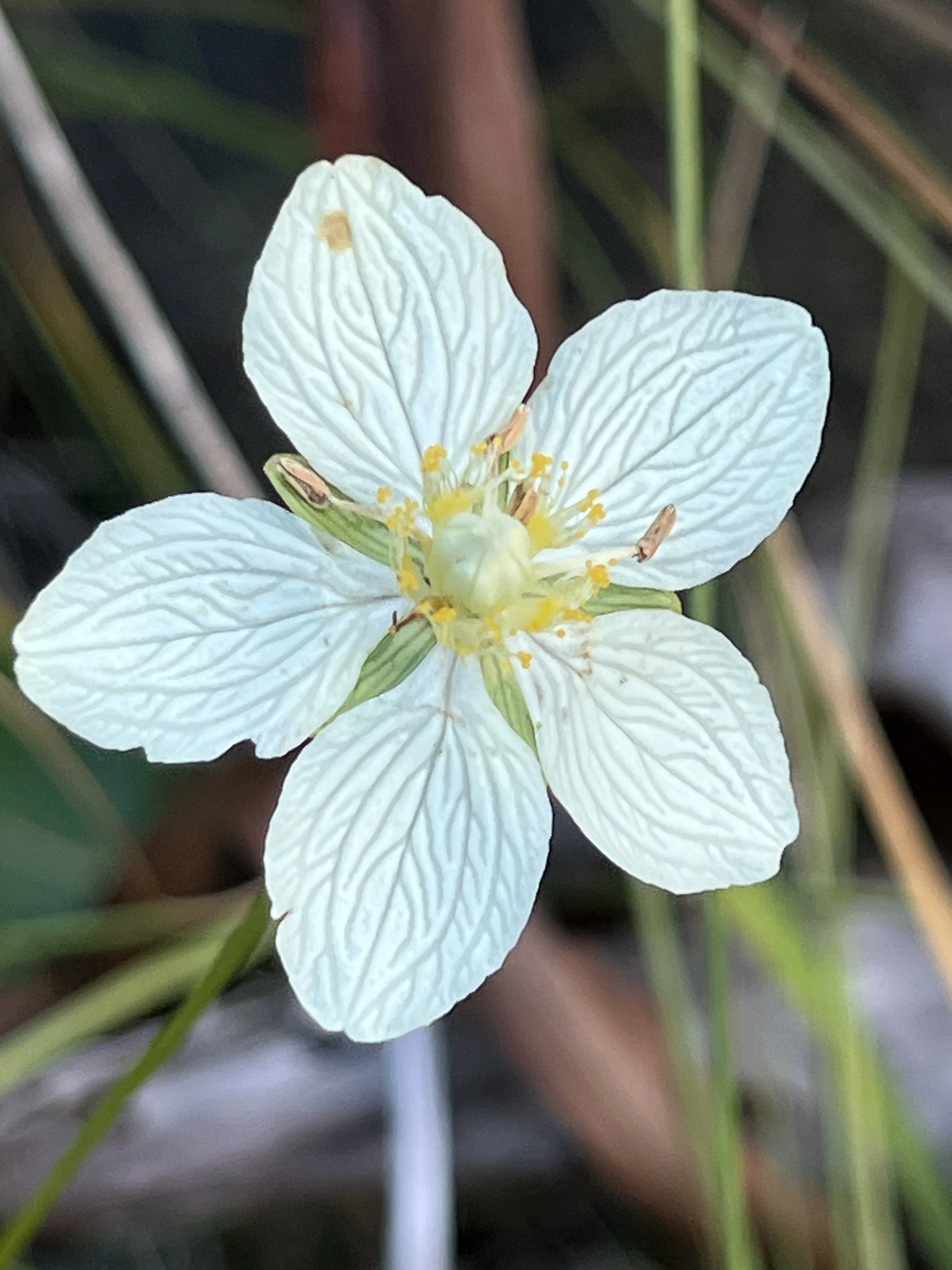
Parnassia Palustris is found among wetlands and serpentine fens in the North Fork Smith drainage. It blooms summer through fall. Photo credit: Mike Splain
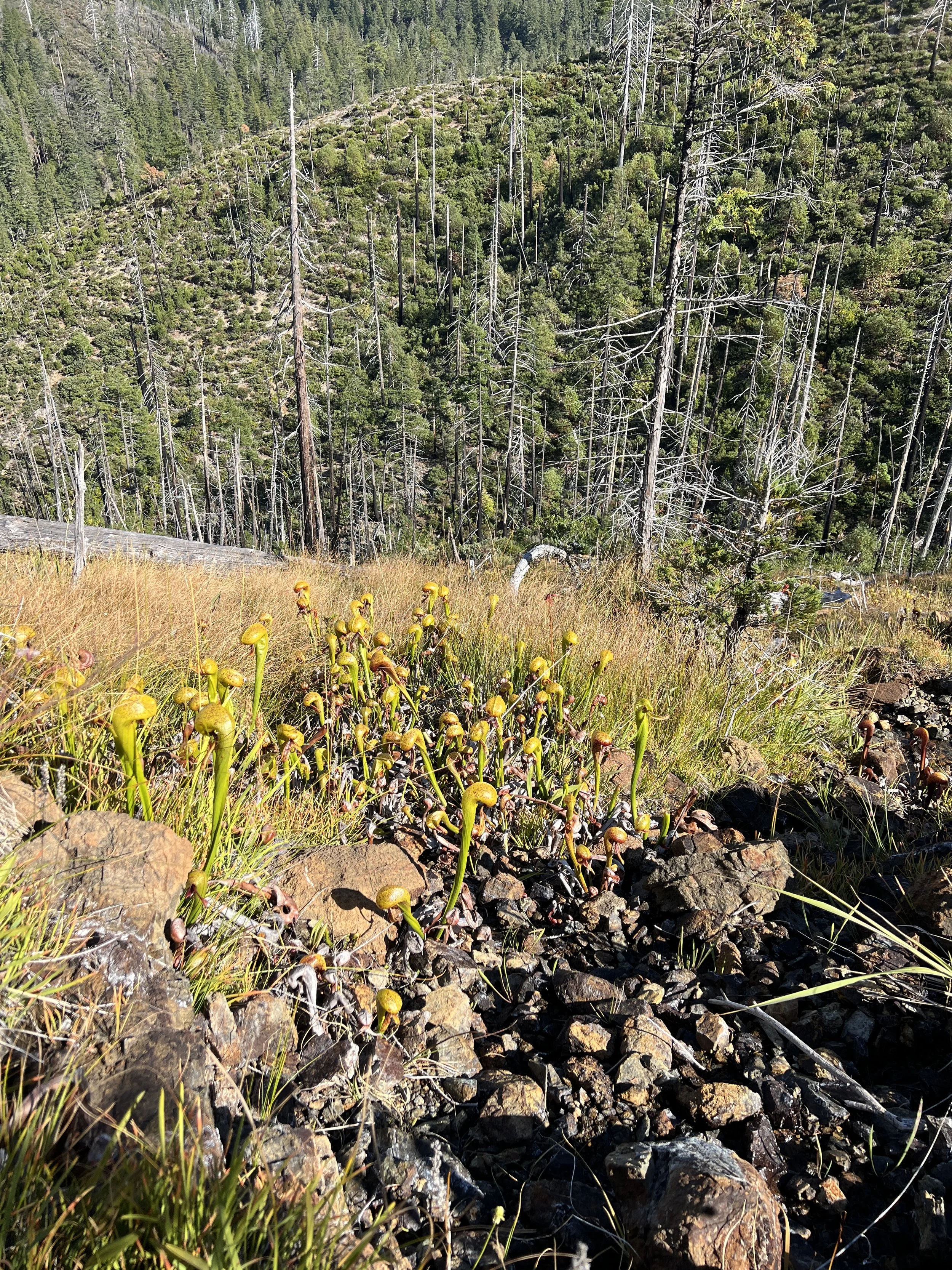
Fens full of Darlingtonia californica – a carnivorous plant – are found throughout the serpentine landscape. The plant is unique in that it can grow in soil conditions with toxic and/or heavy metals. Photo credit: Mike Splain
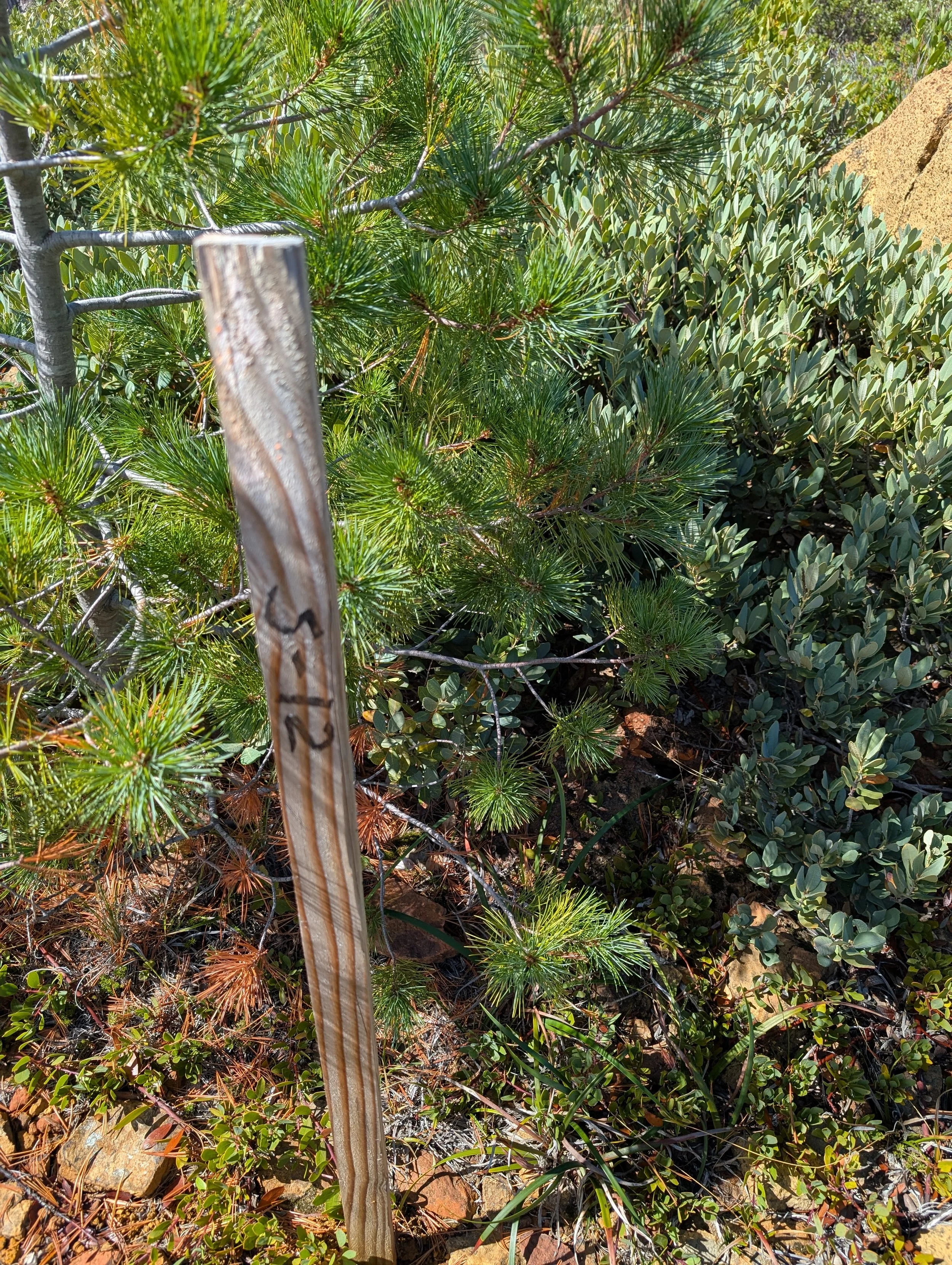
Along a short stretch of the McGrew Trail, and on top of Cleopatra Mountain, there are a series of wooden stakes that designate where Homeland Nickel would like to test for nickel content. The company is working on a proposal to drill as much as 50 feet down into the rock to sample mineral content. KS Wild and partners are closely tracking the permitting process with the Rogue River-Siskiyou National Forest. Photo credit: Michael Dotson
Recently, a Canadian mining company called Homeland Nickel has revived mining claims across 2,800 acres on the top of Cleopatra Mountain. The company has also staked claims across more than a half-dozen locations in southwest Oregon, including Red Flat (Curry County), Woodcock Mountain, and $8 Mountain (the last two being in Josephine County). Communities and concerned citizens around these parts have been dealing with large-scale mining proposals for several decades, but after a short lull, mining companies are emboldened by the Trump Administration’s pro-extraction policies.
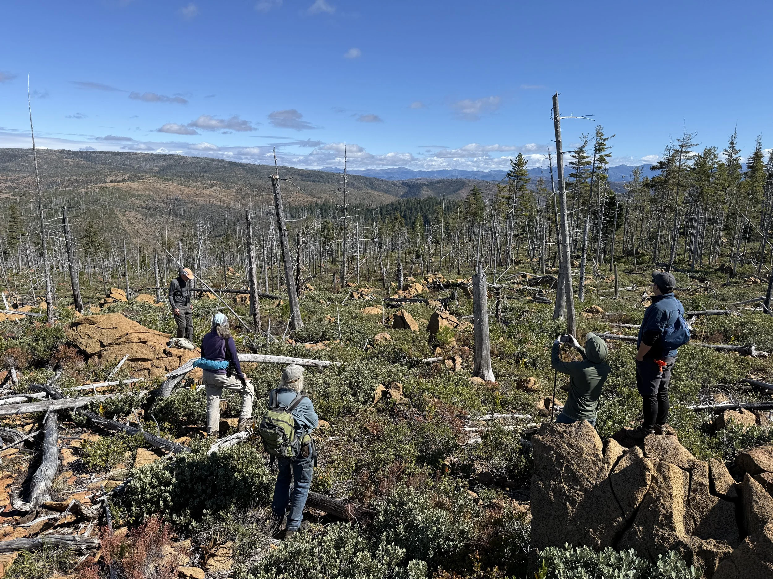
Homeland Nickel has identified about a dozen or so test drilling sites at the top of Cleopatra Mountain, which follows along a small portion of the historic McGrew Trail overland/off-road route. While we were out exploring the landscape on foot, we managed to come across a few off-road enthusiasts and hunters who were also enjoying their time outdoors. We didn’t say much about our reason for the excursion, and it didn’t seem like anyone else out there really understood what this mining company was proposing for their public lands.
Despite an uneasiness around seeing the dozen or so stakes that marked test drilling sites, our group was all smiles.
The views of the North Fork Smith River and the southern edge of the Kalmiopsis Wilderness were endless. At various points, we were lucky to have a 360-degree view that included the Pacific Ocean to our west, the Kalmiopsis Rim to our north, and the jagged peaks of the Siskiyou Crest and High Siskiyous to our south. Our team spotted upwards of a dozen different bird species, and we spied a lone deer at the top of Cleopatra Mountain. (Seems it avoided the hunters that day.) Other signs of life included various types of scat from black bears, coyotes, and probably a large feline. I can’t wait to return in spring and see all the flowers and blooms going off. There was plenty of bear grass with dried stalks lining our path. Needless to say: This is no place for a nickel mine!
Our team of adventurers included KS Wild partners from the Smith River Alliance and Kalmiopsis Audubon. Other coastal residents and conservationists joined us from nearby communities in Curry County, Oregon. Photo credit: Vimal Golding
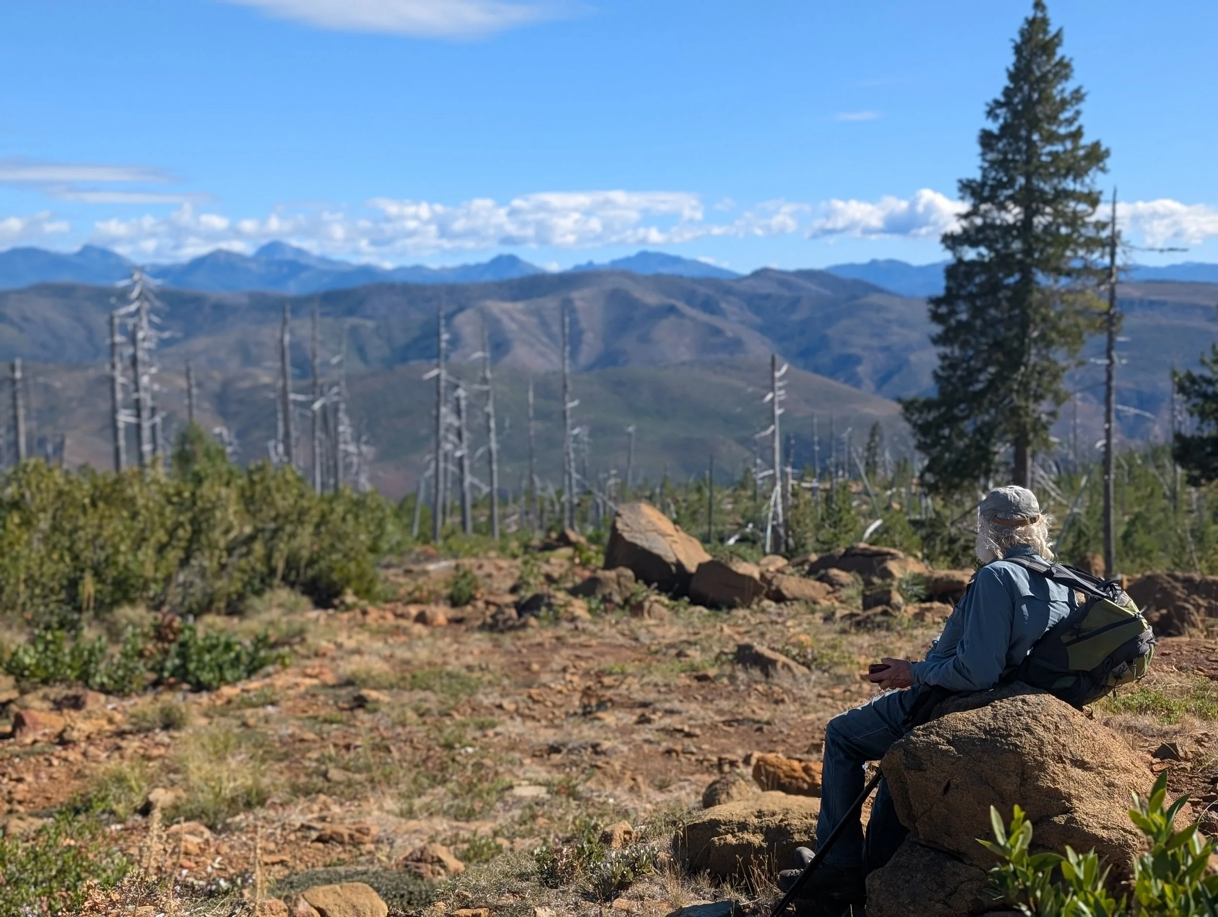
Looking south from Cleopatra Mountain in Oregon, one can see California’s High Siskiyous, including Preston Peak, which is a popular spot in the Siskiyou Wilderness. Credit: Michael Dotson
KS Wild has been working alongside other community groups and conservation advocates for the past decade-plus to try and secure permanent protections for this landscape and surrounding watersheds. Just over the ridge from Cleopatra Mountain is the Rough & Ready Creek watershed which flows east into the Wild & Scenic Illinois River. Mining threats continue to pop up there as well, and KS Wild is working with Kalmiopsis Audubon, Friends of the Kalmiopsis, American Rivers, Pacific Rivers, and Trout Unlimited to try and secure state-level Outstanding Resource Water (ORW) designations for Rough & Ready Creek and the Wild & Scenic Illinois River. (You can scroll down to page 4 in the linked newsletter from Pacific Rivers to learn more about ORWs.) The North Fork Smith River in Oregon was actually the first waterway in Oregon designated as an ORW in 2016, and we are hopeful the designation is a deterrent for any developer that wants to exploit our public waterways and landscapes for private profit.
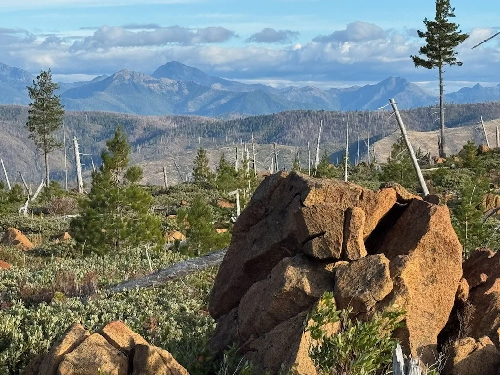
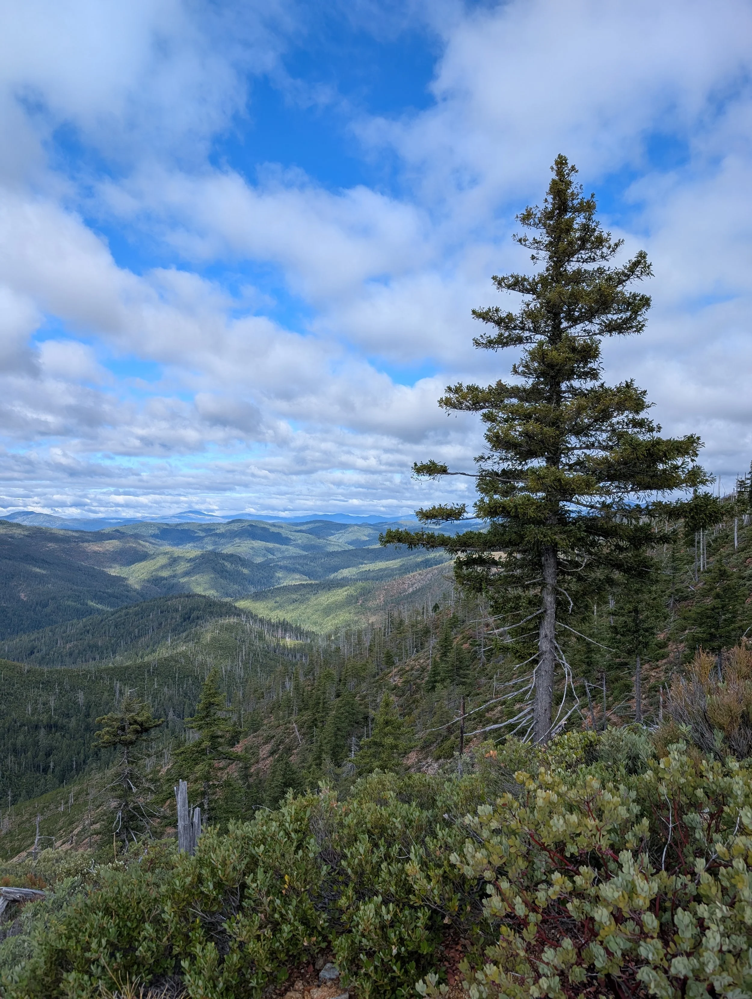
Looking north from Cleopatra Mountain, one has an uninterrupted view of the south rim of the Kalmiopsis Wilderness. From here, one can see Vulcan Peak, Chetco Peak & Red Mountain. Photo credit: Tim Palmer
We drove east from the North Fork Smith River. In this photo, you can see a small sliver of the river and the popular boating put-in called Major Moore’s. Most visitors to this region are coming to raft and kayak the Class IV rapids of the North Fork Smith River, which is usually runnable from late October to early May. Photo credit: Mike Splain
As long as Trump is in office, we are going to have an uphill battle protecting public lands, clean water, and wildlife. However, we’re determined to speak up for special places like the North Fork Smith and Cleopatra Mountain. It’s our hope to prevent further claims from being staked under the 1872 Mining Law, and there is a 20-year moratorium in place for the North Fork Smith River and Rough & Ready Creek watershed that prevents any new claims from being snatched up. Unfortunately, the claims that Homeland Nickel holds are older than the moratorium and thus not subject to the restrictions on mineral exploration.
KS Wild and partners also continue to work with partners to advance bipartisan legislation that would permanently “withdraw” over 100,000 acres of public lands in southwest Oregon, ultimately protecting these watersheds from toxic mining pollution. The Oregon Recreation Enhancement Act and the Smith River National Recreation Area Expansion Act would go a long way towards prioritizing conservation of the aquatic and botanical resources in the North Fork Smith, Illinois and Rogue River watersheds.
TAKE ACTION:
On behalf of our wild rivers and public lands, join us in taking action to defend against toxic mining.
Sign our petition to be included in KS Wild’s correspondence with Congress to request the protection of our treasured wildlands through current policy.
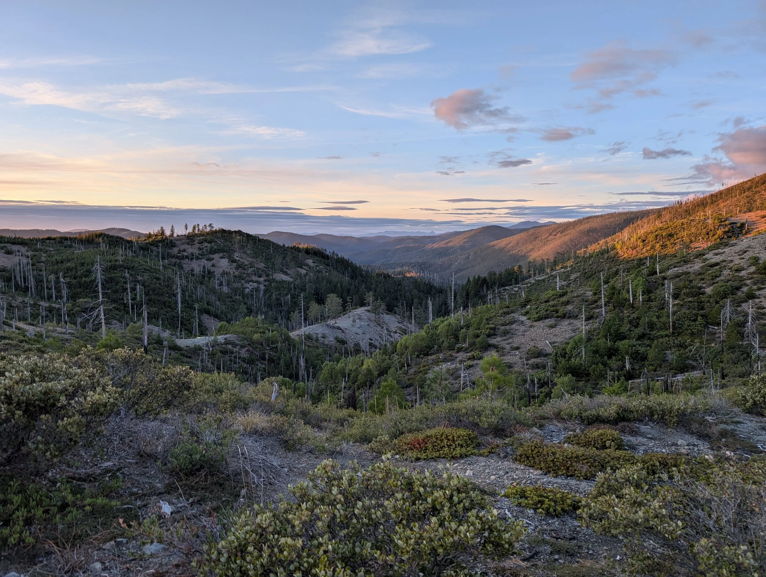
Pictured above: Cleopatra Mountain during sunset. It was a visually stunning trip, with sweeping views in all directions. We camped near the western terminus of the McGrew Trail, where we had views of the Diamond & Baldface Creek drainages. If you’re planning to visit Cleopatra Mountain, make sure you have a solid 4-wheel drive vehicle to help you navigate the rutted and rocky route along the way. Photo cedit: Michael Dotson