
Explore the Inventoried Roadless Areas of the Klamath-Siskiyou bioregion
Written by Haleigh Martin in August 2025
Pop Quiz! What do you know about Inventoried Roadless Areas?
It’s okay if you don’t know much (yet). I’m going to be honest…prior to the Trump Administration’s attempts to roll back the Roadless Area Conservation Rule this summer, I wasn’t super familiar with “Inventoried Roadless Areas” as a conservation concept. But after browsing the nifty interactive map made by our friends at the Outdoor Alliance below, I quickly realized I was more familiar with Inventoried Roadless Areas than I thought!
Let’s start here: What is an Inventoried Roadless Area (IRA)?
IRAs are lands that have been set aside and protected from the construction of new roads. In 2001, the Roadless Area Conservation Rule was adopted with massive public support to protect 58.5 million acres of roadless national forest land in 39 states. The Roadless Rule was the result of years of work and public input in which the public comment period set a record with 1.6 million public comments submitted. You can learn more about IRAs and the current threat here.
IRAs can border wilderness areas, expanding the protection of contiguous wildlife habitat while expanding recreation opportunities, defending clean drinking water, and more. The Klamath-Siskiyou bioregion of southern Oregon and northern California is no stranger to wildlife habitat havens, clean water, and outstanding recreation opportunities, and some of your favorite places may even be protected as an IRA. In fact, the KS bioregion is home to over 1 million acres of Inventoried Roadless Areas!
Let’s highlight some of the IRAs in the region:
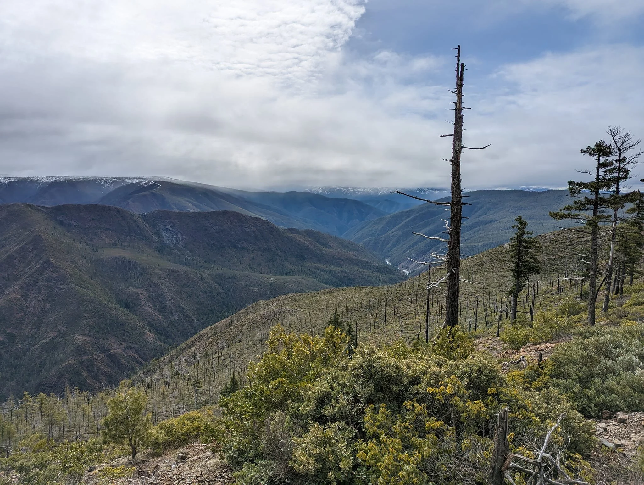
The North Kalmiopsis IRA - 91,273 acres & South Kalmiopsis IRA - 104,357 acres
Important qualities of the North and South Kalmiopsis IRAs
-
South Kalmiopsis IRA: Primarily in Josephine and Curry Counties, with ~280 acres in Del Norte County, California. Elevation ranges from 500 ft to 4,600 ft at Pearsoll Peak.
North Kalmiopsis IRA: Borders the north side of the Kalmiopsis Wilderness, stretching into the watershed of the Wild and Scenic Illinois River.
Combined, these areas encompass over 200,000 acres of contiguous wildlands when considered alongside the Kalmiopsis Wilderness itself.
-
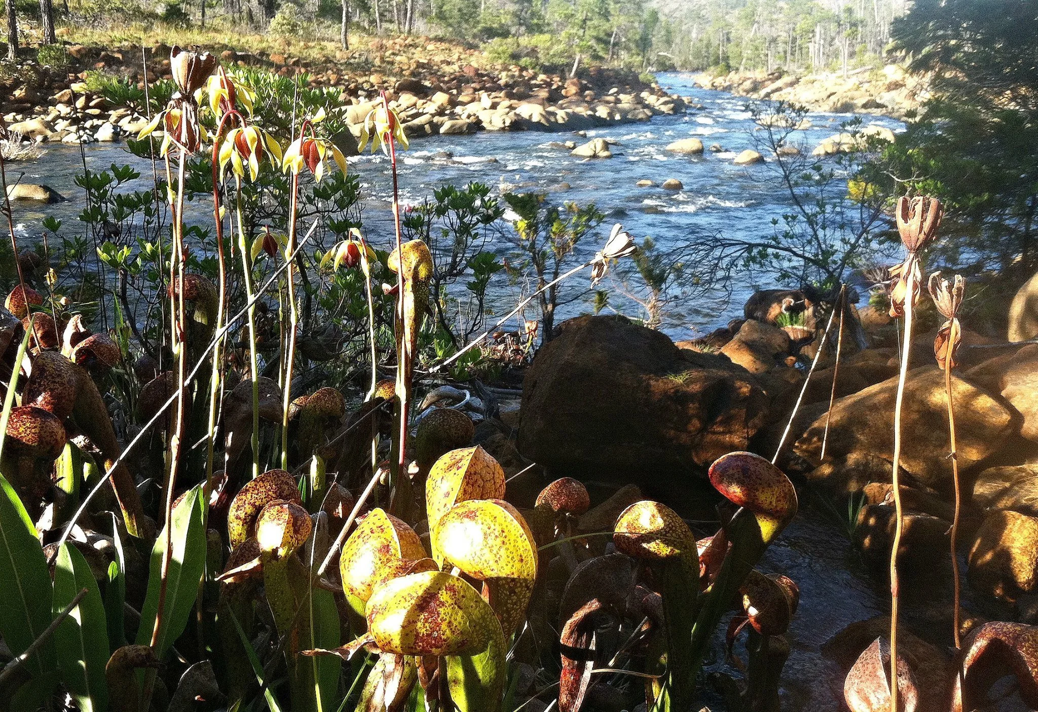
Serpentine Ecosystems
Soils high in heavy metals and low in nutrients create an ecological filter—most plants can’t survive here.
This has led to extraordinary plant endemism; many species occur nowhere else in the world.
Notable endemic plant: Kalmiopsis leachiana, a rare shrub discovered in the region in 1930.
Botanical Hotspots
Host to dozens of rare, threatened, or sensitive plants, including Arabis macdonaldiana, Howell’s mariposa lily, and the carnivorous Darlingtonia californica (cobra lily).
Contain recognized Botanical Areas: Cleopatra, Days Gulch, Oregon Mountain, Rough and Ready Flat, Vulcan.
Unusual habitats include serpentine fens, bogs, and wet meadows—home to unique mosses and orchids.
-
Mammals: Black bear, black-tailed deer, bobcat, mountain lion, and small forest carnivores.
Birds: Northern spotted owl, peregrine falcon, bald eagle, and other raptors.
Fish: Critical cold-water refugia for coho salmon, Chinook salmon, steelhead, and cutthroat trout—including spawning and rearing habitat.
Reptiles & Amphibians: Foothill yellow-legged frog, Pacific giant salamander, and unique serpentine-adapted reptiles.
-
These IRAs protect headwaters and tributaries of the Illinois River, North Fork Smith River, and Chetco River, all of which are Wild and Scenic Rivers.
Intact roadless landscapes prevent sedimentation, keeping streams crystal-clear and cold—vital for threatened salmonids.
Serve as natural water storage, moderating seasonal flows and improving drought resilience downstream.
The North and South Kalmiopsis IRAs lie within the rugged Klamath-Siskiyou Mountains of southwestern Oregon, adjacent to the Kalmiopsis Wilderness and the Wild and Scenic Illinois and North Fork Smith Rivers. Together, they form a vast expanse of wild, roadless land—critical for biodiversity, clean water, and climate resilience.
These IRAs protect some of the most geologically unusual and biologically rich terrain in North America, dominated by serpentine and peridotite soils that foster a unique array of rare and endemic species.
Impressive Facts
World-class biodiversity: The Klamath-Siskiyou region is recognized by scientists as one of the most botanically diverse temperate forest regions on Earth.
Geologic rarity: Part of the Josephine Ophiolite—ancient seafloor rocks uplifted over 150 million years ago.
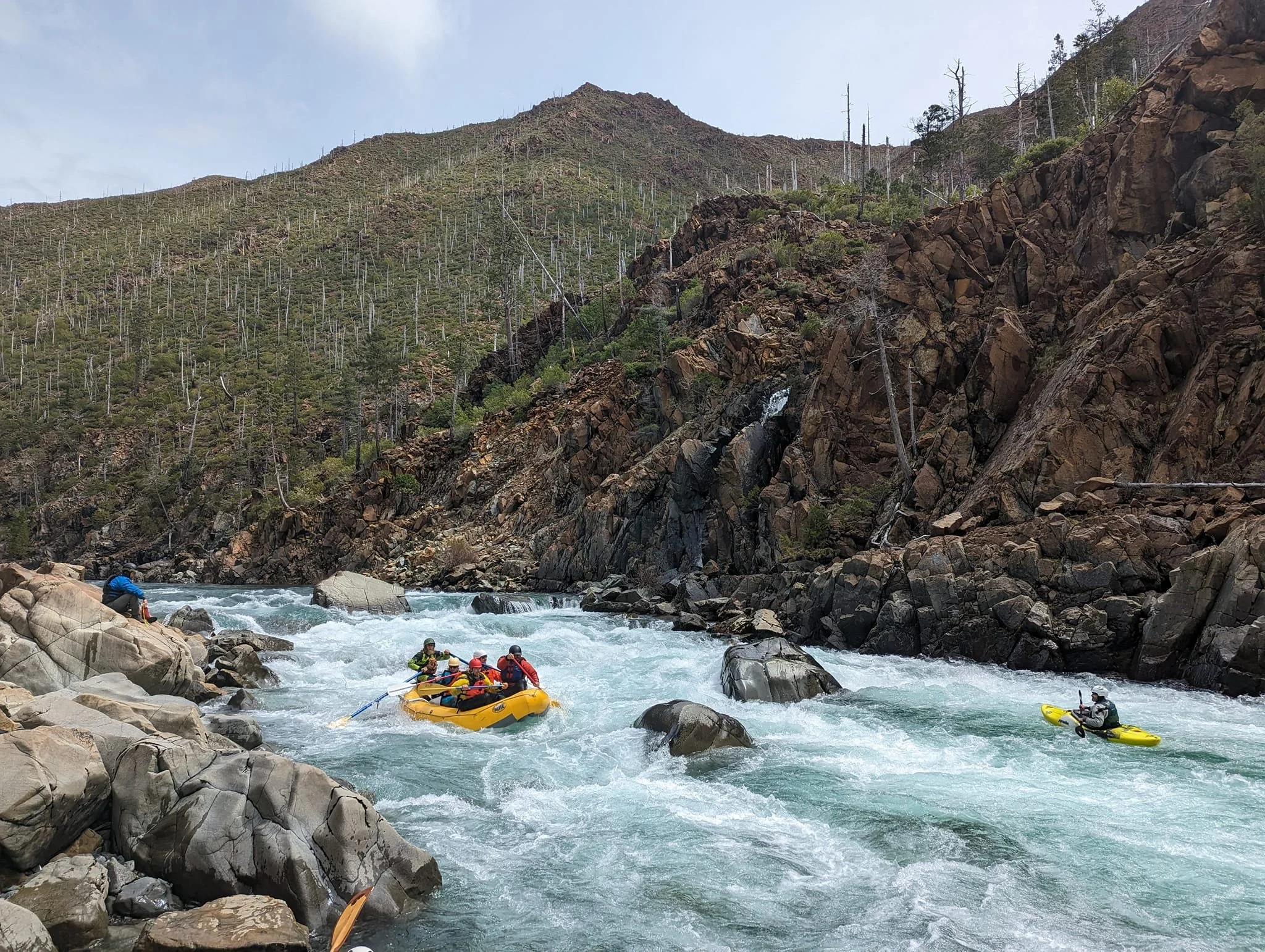
Recreation value: Offers whitewater rafting on the Illinois River, backcountry hiking, botanical exploration, and hunting in wild, scenic settings.
Climate refuge: Elevation and aspect diversity create microclimates that allow species to migrate and persist as the climate changes.
The North and South Kalmiopsis IRAs are not just remote patches of forest—they’re living museums of ancient geology, rare botany, and wild rivers. Protecting them means safeguarding one of the most irreplaceable natural treasures in North America, a refuge for species found nowhere else, and a cornerstone for clean water and climate resilience in the region.
North Fork Smith IRA - 37,898 acres
Important qualities of the North Fork Smith IRA
-
Botanical Hotspot: The North Fork Smith IRA sits on serpentine soils—nutrient-poor but mineral-rich ground that has driven plants to evolve unique adaptations. This has created one of the most botanically diverse areas in North America.
Rare & Endemic Plants: Includes Darlingtonia californica (cobra lily, a carnivorous plant), Kalmiopsis leachiana (a rare endemic shrub found only in this region), and numerous wildflowers and conifers that exist nowhere else on Earth.
Part of the Klamath-Siskiyou ecoregion, recognized globally as a biodiversity hotspot on par with the Amazon and Himalayas.
-
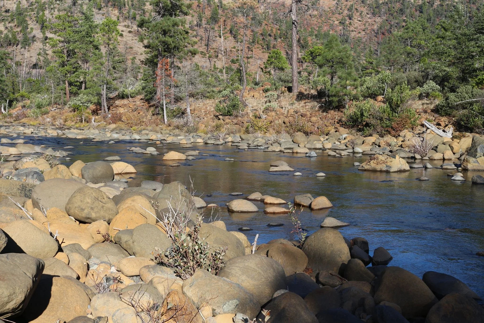
Cold, Clear Water: The North Fork Smith River is a pristine, undammed, salmon- and steelhead-bearing stream.
Salmonids: Supports coho salmon (threatened under the Endangered Species Act), Chinook salmon, steelhead trout, and cutthroat trout.
Wildlife Habitat: Old-growth forests and serpentine barrens provide critical habitat for northern spotted owl, Pacific fisher, marten, elk, black bear, and diverse bird species.
Amphibians: Rare species like the Siskiyou Mountains salamander depend on the cool, moist forest floor microclimates.
The North Fork Smith Inventoried Roadless Area (IRA) in California’s Six Rivers National Forest is one of the crown jewels of the Klamath-Siskiyou region. It lies along the Oregon–California border, buffering the North Fork Smith River and ultimately becomes one of the cleanest, wildest rivers on the West Coast. The North Fork Smith IRA is a rare stronghold of wildness—an intact watershed with unmatched botanical diversity, thriving salmon runs, pristine waters, and globally significant ecological values. Its conservation is essential not only for Oregon and California but for the broader effort to protect North America’s last great wild places.
Impressive Facts
Exceptional Water Quality: The North Fork Smith River is so clean that Oregon designated it an Outstanding National Resource Water—a top-level protection. Oregon’s portion of the watershed is equally pristine and supplies drinking water to communities downstream.
Wilderness Character: The IRA is rugged, wild, and roadless—providing solitude and backcountry recreation for hikers, anglers, and hunters.
Connectivity: It lies just south of the Kalmiopsis Wilderness, forming part of a contiguous wildlands complex that supports wide-ranging species and climate resilience.
Scenic & Recreational Value: Though remote, the area draws recreationists seeking clear swimming holes, wildflower viewing, and backcountry fishing in one of the last untouched river systems of the Pacific Northwest.
Kangaroo IRA - 54,970 acres
Important qualities of Kangaroo IRA
-
In the nearby Cook and Green Pass Botanical Area, adjacent to Kangaroo IRA, botanists have recorded over 300 native plant species, including rare varieties like Baker’s cypress, Brewer’s spruce, mountain lady slipper, splithair paintbrush, Newberry’s gentian, Siskiyou fritillaria, and Howell’s lousewort.
The Cook and Green Pass region acts as a botanical crossroads, dividing the eastern and western Siskiyou Mountains and hosting one of California’s richest plant assemblages.
-
The Kangaroo IRA contributes to habitat connectivity crucial for species like fisher, marten, and wolverine, which are sensitive to landscape fragmentation .
It supports northern spotted owl and coho salmon critical habitat; projects like the Seiad-Horse logging plan risk degrading this habitat and impacting these threatened species.
-
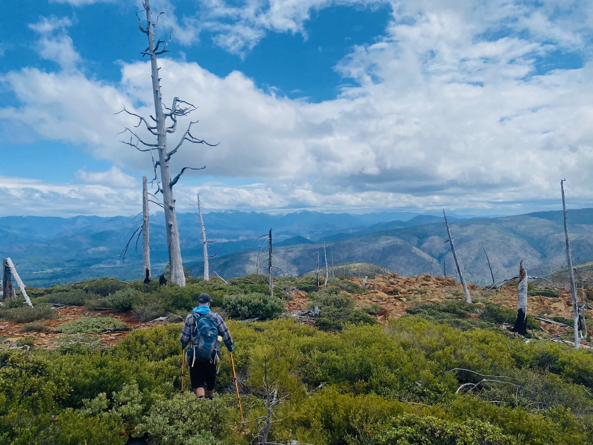
The 2017 Cedar Fire, part of the Eclipse Complex, burned across the Kangaroo Roadless Area. The fire acted in a largely natural, mixed-severity pattern—helping reduce fuel loads, maintain healthy mosaic conditions, and foster habitat resilience. Natural fire regimes and old-growth forests contribute to climate resilience, carbon storage, and habitat complexity.
-
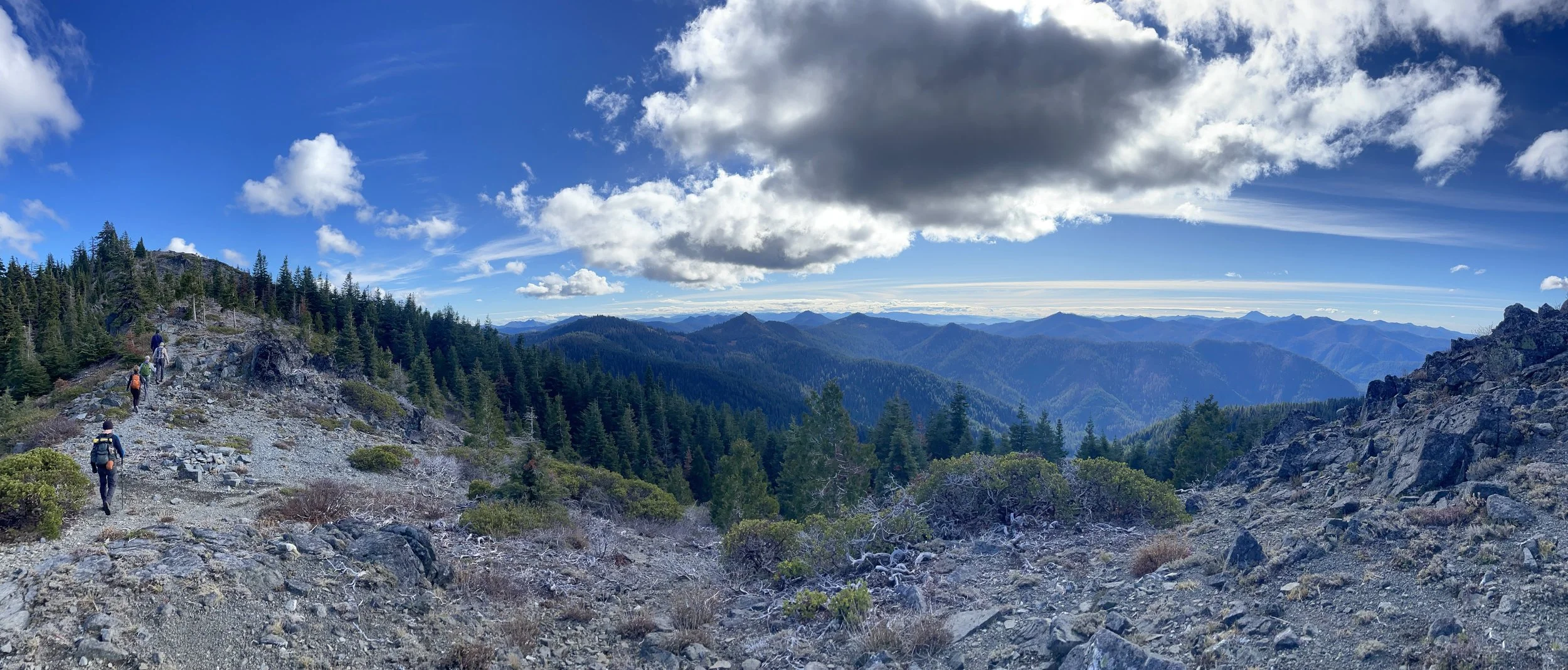
Trails like the Pacific Crest Trail traverse this landscape, offering solitude and wilderness experiences increasingly rare in modern times.
The Kangaroo IRA is a remote, undeveloped landscape nestled in the Klamath National Forest, adjacent to notable areas like the Condrey Mountain IRA, Red Buttes Wilderness, and the Cook and Green Pass Botanical Area. Positioned on the Siskiyou Crest, this region forms part of a larger, rugged wildlands corridor that facilitates habitat connectivity between watersheds and mountain ranges. It also lies within the Johnny O’Neil Late-Successional Reserve, designated to protect late successional and old-growth forest landscapes and to maintain connectivity for wildlife such as the northern spotted owl and Pacific fisher.
The Kangaroo IRA is a keystone of ecological integrity in northern California—a sanctuary for rare plants, resilient forest communities, and wildlife connectivity. Its conservation protects critical biodiversity, supports long-term species survival, preserves natural fire dynamics, and maintains high-value recreational opportunities. Ensuring its protection from development or logging is vital not just for this special landscape, but also for broader conservation goals across the region.
Condrey Mountain IRA - 9,068 acres


Important qualities of Condrey Mountain IRA
-
The IRA supports spectacularly diverse old-growth forests, situated at the edge of the White Mountain Botanical Area—a region of high botanical importance. This forest structure and composition offer rich habitat, including ancient incense cedars.
-
Wildlife thrives here: elk herds traverse the area, bears roam freely, and it has hosted one of the region’s last-known wolverine sightings.
The location and high-quality habitat make it an important corridor for wildlife movement across the Siskiyou Crest region.
-
The Pacific Crest Trail passes through this area, and the Condrey Mountain IRA offers a campsite with a vital water source for PCT hikers. Also - the views up there are incredible.
Condrey Mountain IRA spans approximately 9,000 acres, located on the northern slope of the Siskiyou Crest within Rogue River–Siskiyou National Forest and partly in Klamath National Forest, just south of the Oregon–California border near Elliott Creek. Geologically, the area sits within the Klamath Mountains province, particularly centered on a structural dome of Condrey Mountain Schist—a formation of metamorphic sedimentary and volcanic rocks within the western Paleozoic–Triassic belt.
Its remoteness and exceptional biodiversity led a past Forest Service botanist to propose federally designating Alex Hole as a botanical area—though the proposal was not adopted. Alex Hole, a remote wet meadow system on its edge, harbors numerous rare bryophytes and unusual plant communities, while serving as a vital water source and campsite for Pacific Crest Trail hikers. Learn more about our work protecting Alex Hole meadow here.
The Condrey Mountain IRA is a jewel of botanical diversity, old-growth forest integrity, and wildlife habitat in the Siskiyou region. Its geologic distinctness, ecological resilience through fire, critical wildlife connectivity, and ongoing conservation victories all underscore its value. Yet, threats from grazing, logging, and unauthorized access continue to pressure this landscape. Conserving its untouched character is not only vital for local biodiversity, but also for sustaining broader regional ecological networks.
Packsaddle IRA - 9,366 acres
Important qualities of Packsaddle IRA
-
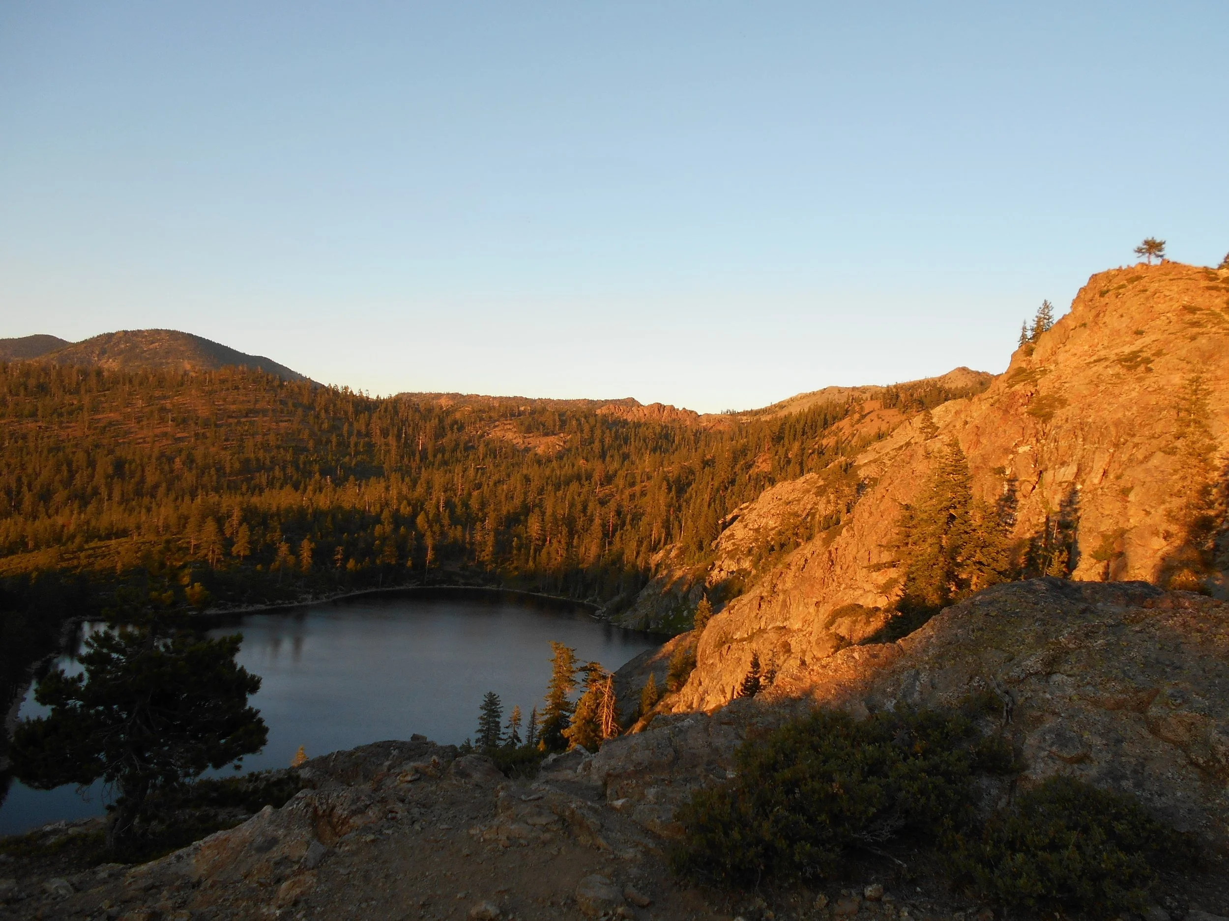
The Oregon portion of the North Fork Smith—including Packsaddle’s streams and Darlingtonia (cobra-lily) wetlands—is designated Outstanding Resource Waters, with policies to keep current exceptional water quality from being degraded. These cold springs and fens help sustain summer baseflows and cool temperatures critical for salmonids.
-
Much of the area is underlain by serpentine—nutrient-poor, high-magnesium soils that foster unique plant communities.
Port Orford cedar thrives along serpentine seeps and wetlands here and plays an outsized role in shading streams and forming stable wood jams, though it’s vulnerable to Phytophthora lateralis (root rot), so keeping roadless buffers is a big deal.
Serpentine Darlingtonia fens in the Smith watershed harbor a suite of rare plants of regional conservation focus, including Epilobium oreganum (Oregon fireweed), Gentiana setigera (Mendocino gentian), and Hastingsia bracteosa (large-flowered rush-lily), among others.
-
Packsaddle’s creeks feed habitat used by Chinook and coho salmon (coho = ESA-threatened SONCC DPS), steelhead, coastal cutthroat trout, and Pacific lamprey. The North Fork Smith in Oregon is also a Key Watershed under the Northwest Forest Plan.
Outside the wilderness, much of the watershed is mapped as Late-Successional Reserve, supporting old-forest-associated species such as the Northern Spotted Owl (and, more broadly across the forest, Pacific fisher and other late-successional fauna).
Packsaddle IRA sits in the Rogue River–Siskiyou National Forest on the Oregon side of the North Fork Smith River watershed, adjoining the South Kalmiopsis IRA and near the Kalmiopsis Wilderness. It’s part of a largely roadless, undammed headwaters complex that feeds one of the clearest rivers on the West Coast. Roughly 88% of Oregon’s North Fork Smith watershed lies within the Kalmiopsis Wilderness plus the South Kalmiopsis and Packsaddle IRAs, underscoring how Packsaddle helps keep this headwaters block whole.
Roadless serpentine basins are globally scarce; Packsaddle helps anchor one of North America’s richest concentrations of rare serpentine plants and communities. No dams, exceptional water clarity, and intact cold-water inputs from springs and fens—exactly what salmon and steelhead need as summers warm. Together with adjacent roadless and wilderness lands, Packsaddle provides large, continuous late-successional habitat and a sediment-secure corridor from ridgelines to fish-bearing streams.
The Klamath-Siskiyou region holds many more IRAs than what is listed above. In fact, the KS region is home to 1,021,331 acres of federally-recognized Inventoried Roadless Areas. Click on the drop-down menu below to explore the comprehensive list of all IRAs in the region. Use the map above to see where they are located.
-
Brown Mountain (6,694 acres)
Brown Mt Fremont-Winema portion (3,117 acres)
McDonald Peak (9,431 acres)
Little Grayback (7,986 acres)
Kinney (7,505 acres)
Kangaroo Oregon (21,507 acres)
South Kalmiopsis (104,461 acres)
Packsaddle (8,478 acres)
Mt. Emily (14,203 acres)
Vulcan Peak (1,305 acres)
Windy Valley (9,896 acres)
North Kalmiopsis (91,497 acres)
Quosatana Creek (5,137 acres)
Briggs Creek/Squaw Mountain (7,921 acres)
Lower Briggs (5,915 acres)
Shasta Costa (14,409 acres)
Wild Rogue (3,349 acres)
Potato Mountain (5,984 acres)
Grassy Knob (5,668 acres)
Condrey Mountain in California portion of RRSNF (9,068 acres)
-
Siskiyou (54,038 acres)
Callahan Flow (3,231 acres)
Indian Creek (5,011 acres)
Kangaroo (40,617 acres)
Condrey (2,923 acres)
Grider (10,647 acres)
Tom Martin (9,030 acres)
Kelsey (3,237 acres)
Johnson (10,651 ares)
Ukonom (4,621 acres)
Box Camp (858 acres)
Boulder (435 acres)
Muse (238 acres)
Shackleford (1,679 acres)
Portuguese (18,915 acres)
Russian (21,711 acres)
Black (6,530 acres)
-
Packsaddle (3,862 acres)
North Fork Smith (37,898 acres)
Monkey Creek (9,107 acres)
Kelly (5,195 acres)
Ship Mountain (11,936 acres)
Siskiyou A (1,017 acres)
Siskiyou B (18,871 acres)
Siskiyou (3,035 acres)
Blue Creek RARE I (12,134 acres)
Slide Creek (11,458 acres)
Orleans Mountain C (15,589 acres)
Orleans Mountain B (17,182 acres)
Bell Quinby (11,556 acres)
Cow Creek (1,271 acres)
Board Camp (4,527 acres)
Pilot Creek (9,192 acres)
Mt. Lassic (6,643 acres)
Solider (14,918 acres)
Salt Creek (9,505 acres)
Big Butte - Shinbone (1,102 acres)
-
Bell Quinby (11,556 acres)
Cow Creek (22,627 acres)
China Springs B (568 acres)
Fisher Gulch B (4,791 acres)
Eagle (6,553 acres)
Panther (12,016 acres)
Underwood (3,046 acres)
Pattison (29,298 acres)
South Fork (16,786 acres)
Wells Mountain (5,919 acres)
Chinquapin (22,041 acres)
Salt Gulch (6,511 acres)
Chanchelulla (3,916 acres)
West Beegum (5,198 acres)Fisher Gulch (4,791 acres)
East Beegum (8,425 acres)
East Fork (6,201 acres)
Penney Ridge (5,226 acres)
Murphy Glade (1,015 acres)
Mt. Shasta B (2,809 acres)
Mt. Shasta A (686 acres)
Mt. Shasta C (292 acres)
Mt. Eddy (7,232 acres)
Castle Crags (1,619 acres)
Castle Crags A (113 acres)
Bonanza King (16,402 acres)
Slate Creek (6,636 acres)
Dog Creek (5,001 acres)
Backbone (11,465 acres)
East Girard (27,893 acres)
Devil’s Rock (16,209 acres)
Kettle Mountain (4,589 acres)
PREPARE FOR ACTION
Dozens of U.S. representatives and senators have signed onto the Roadless Area Conservation Act of 2025 which would codify the Roadless Rule so that only an act of Congress could roll it back.
As we track the progress of that and an upcoming open comment period for public weigh-in, we will be offering routes of action you can take to let your elected officials and other decision makers know you value the Roadless Rule and all the wild spaces it serves to protect.