
5. Fen Trail
The Fen trail is about an hour drive from Fort Jones, California and is located in one of the most botanically unique areas of the Klamath National Forest. A short spur trail brings you to an old-growth forest featuring Shasta red fir, Jeffrey pine, and more!
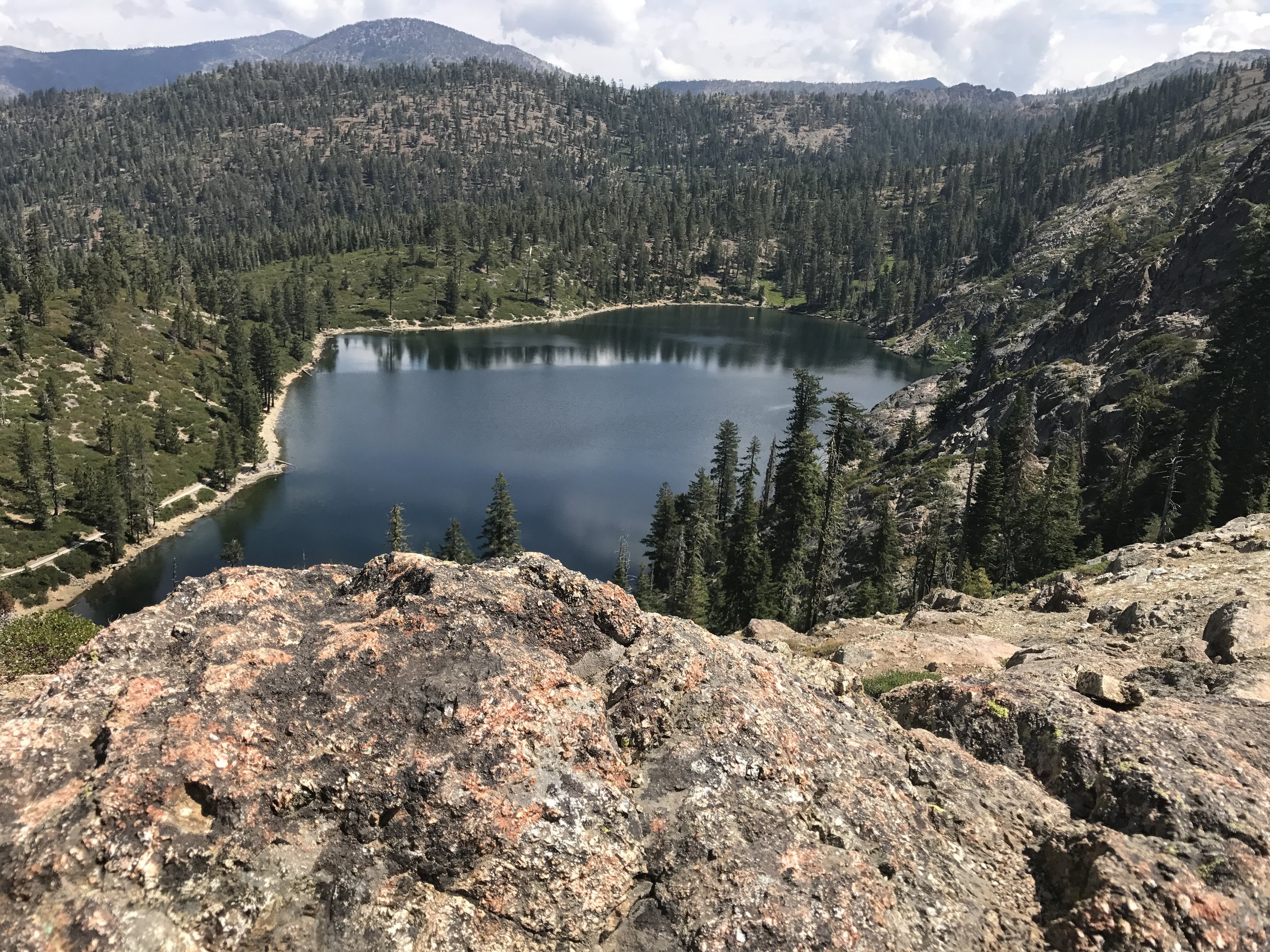
Kangaroo Lake. Photo Credit: Joseph Vaile
Hike Description:

Map of the Fen Trail from Michael Kauffmann’s “Conifer Country” book.
This high elevation trail (starting at 6000 ft) is of moderate to easy difficulty. The trail starts at the edge of the road just before the Kangaroo Lake campground, and ends at the top of the ridge on the Pacific Crest Trail (PCT). Mileage one-way is 1.25 miles, with an elevation gain of 600 feet. Allow two hours to complete the trail, round trip, at a leisurely pace. This trail is not wheelchair accessible.
The short but steep trail begins to ascend from the start and crosses Rail Creek at about ½ mile. Stay left at the trail junction minutes later. (Note: Heading right leads to Forest Road 40N62 and Cooper Meadow.) Cross the stream a third time at 0.65 miles, then climb to a well-worn wooden trail sign (barely readable) on the left. A short spur trail heads right to an old-growth forest, featuring Shasta red fir, Jeffrey pine, mountain hemlock, and white fir. This hike features unique high elevation old-growth trees that are rare to find.
Viewing Information:
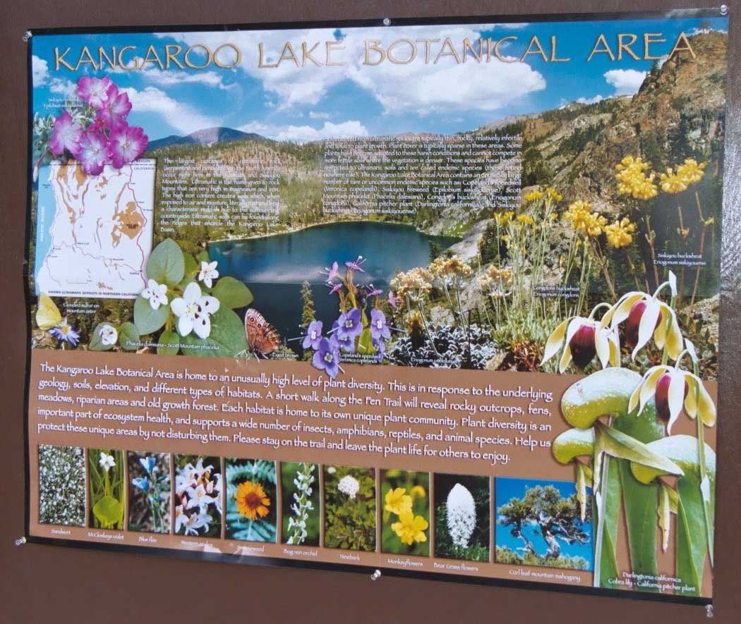
Located in one of the most botanically unique areas of the Klamath National Forest, this trail is within a designated Botanical Special Interest Area where many unusual botanical and geologic features can be seen. Nine interpretive sites along the trail highlight uncommon species and features such as fens exhibiting rare California pitcher plants, serpentine rock outcrops displaying numerous Forest Service listed Sensitive and Klamath Watch List plant species, an overview of Kangaroo Lake, and an avalanche path. The trail culminates at the Scott and Trinity Rivers Divide with a commanding panoramic view of the surrounding landscape.
If you want to continue hiking, Robbers Meadow is about 1 ¼ miles north on the PCT. Bull Lake would be another 1 ½ miles north from Robbers Meadow along the PCT. This is an 8 acre lake, 20 feet deep, at an elevation of 6,530 feet.
Michael Kauffmann's “Conifer Country: A natural history and hiking guide to 35 conifers of the Klamath Mountain region” is a great resource to learn more about this trail system.
Directions:
Travel on Interstate 5 to Yreka, CA. From Yreka, take Highway 3 to Fort Jones, CA. From Ft. Jones, continue traveling south on Highway 3 approximately 25 miles. Stay left at the split for Gazelle Road and Highway 3 (follow Gazelle Road). Travel approximately 8 miles to forest road 41N08. Turn right and follow signs to Kangaroo Lake Campground.
Caution:
Always use caution, good planning, and check in with managing agencies before embarking on a trip. Don’t forget to pack maps, extra layers, plenty of food and water, a first aid kit, and a cell phone in case of an emergency. It is a good idea to let someone know where you are going and when you intend to be back. Be aware that weather and road conditions can change in an instant. KS Wild assumes no liability if you intend to visit any of the places featured in our materials.