
Field Report: Wild rivers threatened by nickel mining & exploration
Written by Michael Dotson in June 2026
take action today
Sign our petition to protect Illinois Valley waterways from Canadian mining interests.
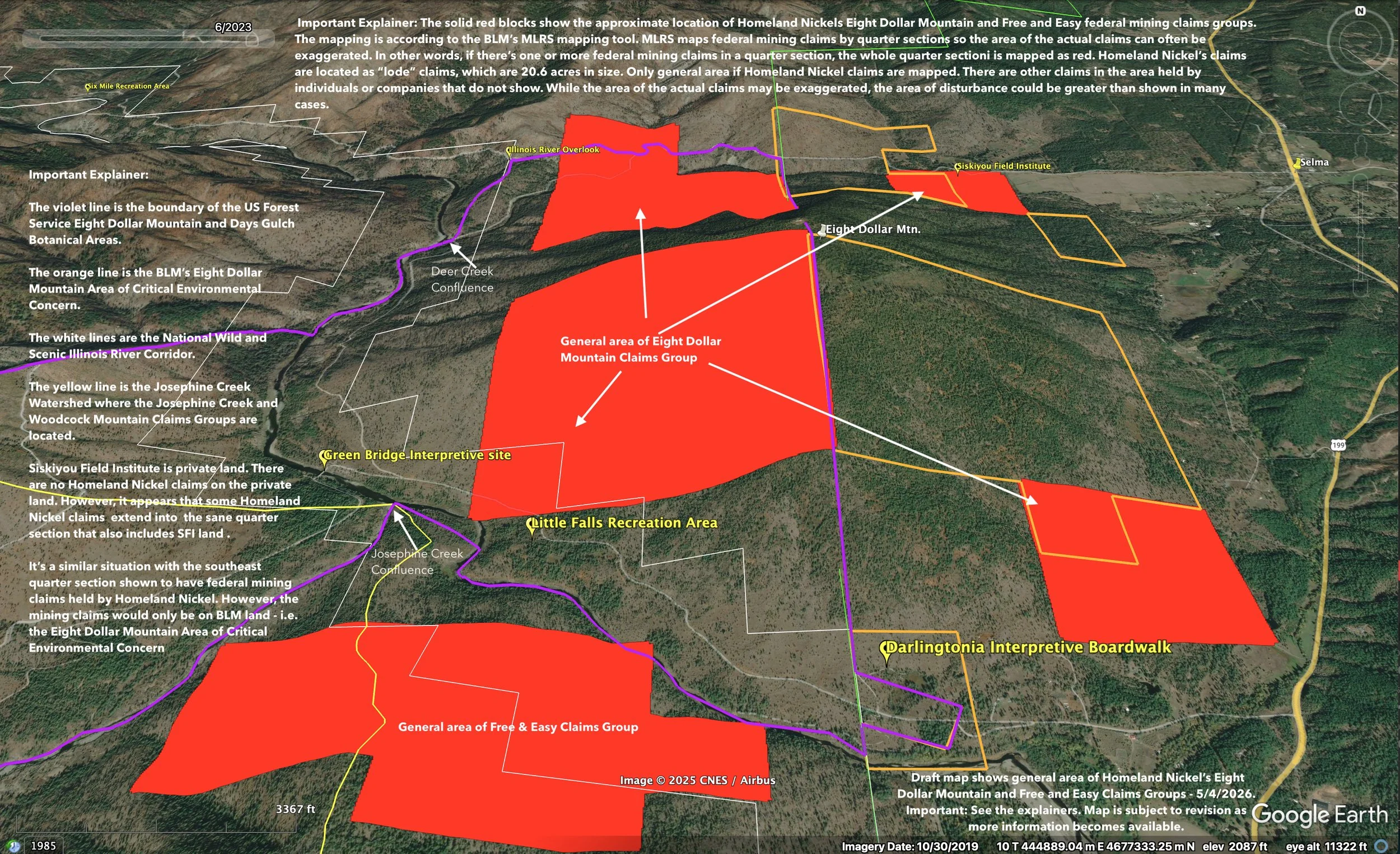
In a follow up to last year’s field reports at Red Flat and Cleopatra Mountain, I spent a beautiful, mild day in June exploring the Illinois River Valley in southwest Oregon’s Josephine County. Just like at Red Flat and Cleopatra Mountain, Canadian mining company Homeland Nickel has staked more than 10,000 acres of mining claims in the Illinois River watershed, including exploration sites near Rough & Ready Creek, Woodcock Mountain, Josephine Creek, and Eight Dollar Mountain. On June 9th, I joined partners from the Wild Salmon Center, Kalmiopsis Audubon, Illinois Valley Chapter of the Sierra Club, Water League, and American Whitewater to visit several mineral exploration sites throughout the Illinois River Valley. This part of the state is home to zip codes that include Selma, Cave Junction, and O’brien, all of which are surrounded by public lands stewarded by USFS and BLM.
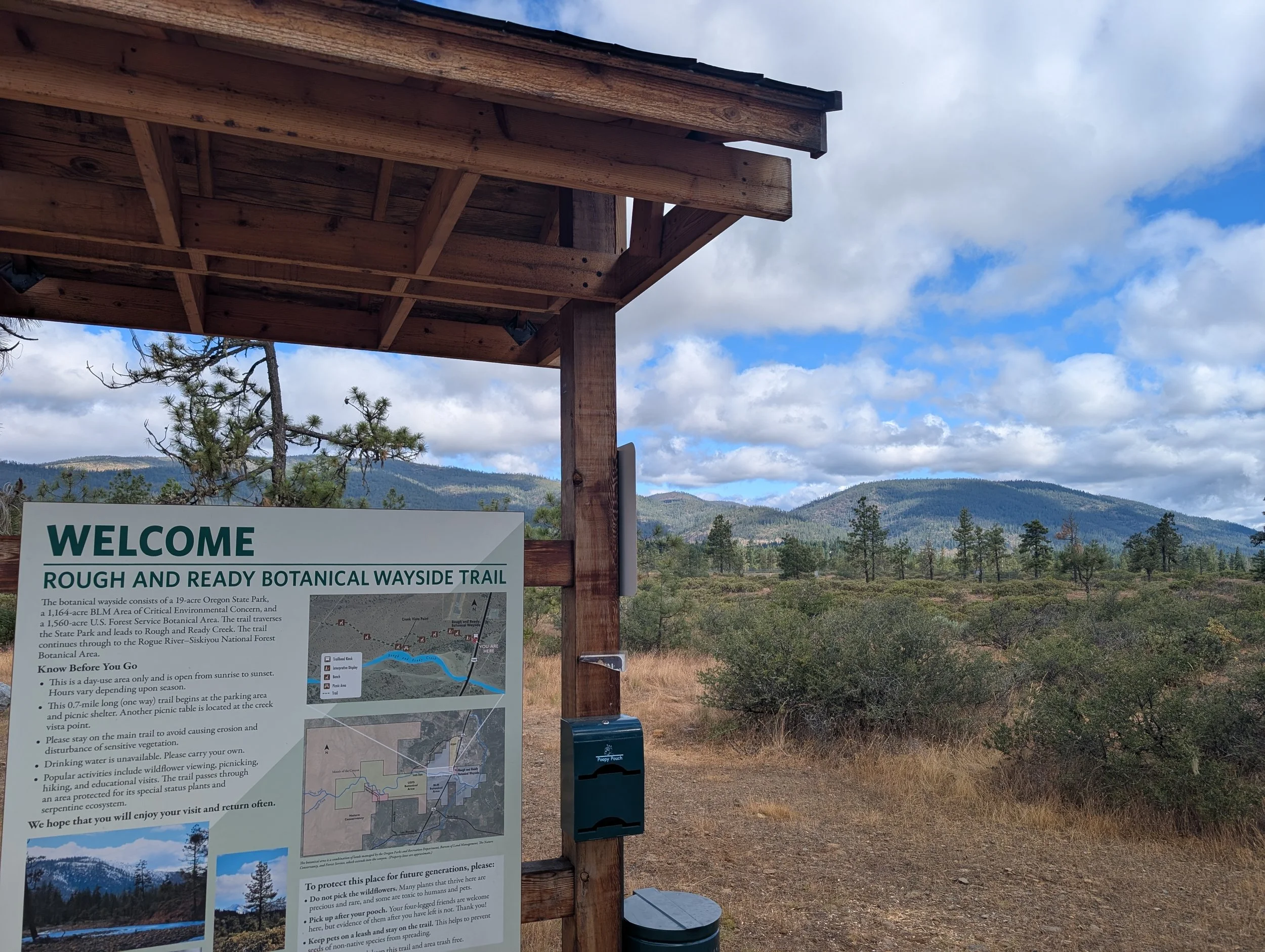
A welcome sign and picnic table greet visitors to the Rough & Ready Creek Botanical Wayside along Oregon’s Highway 199, a few miles south of Cave Junction.
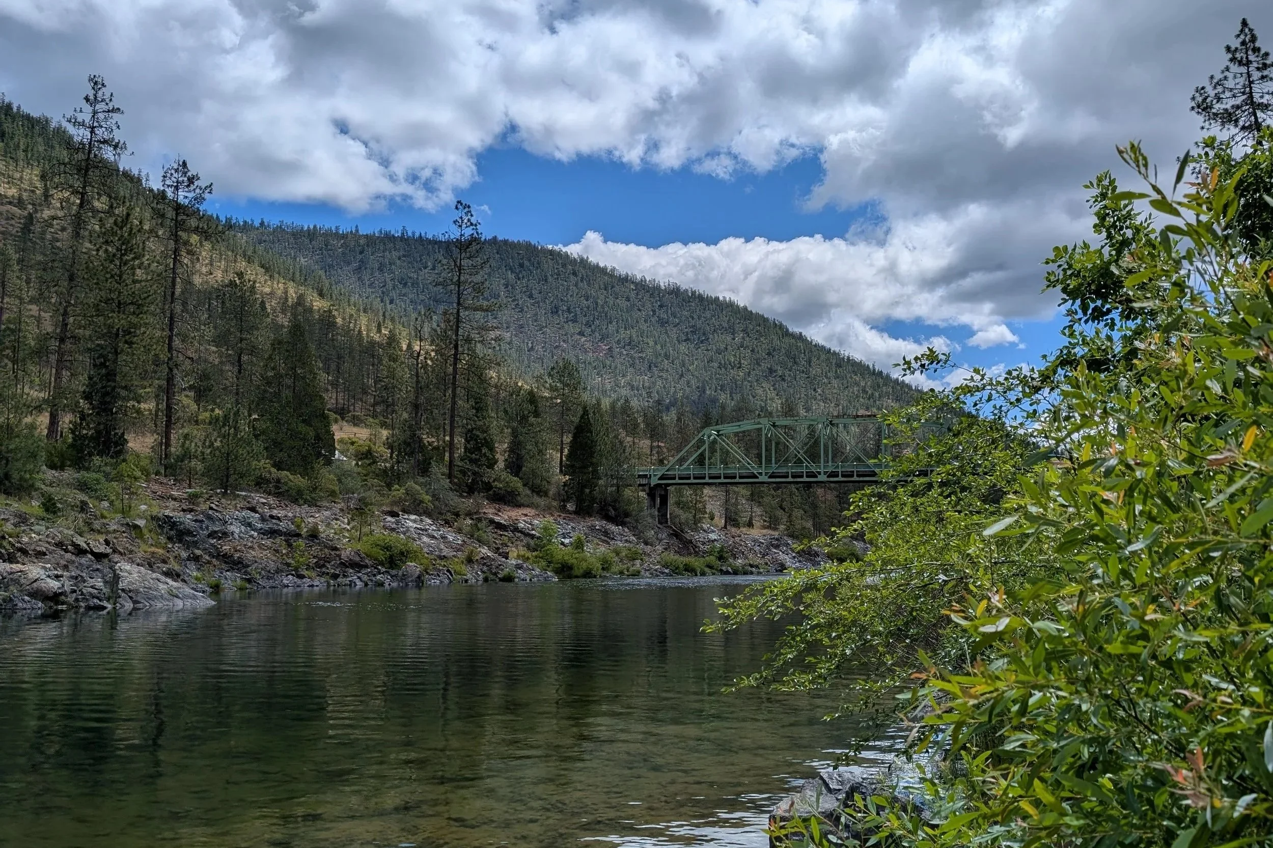
During the wet season, Rough & Ready Creek flows over the serpentine cobbles that characterize the riverbed. While it might look dry in the summer and early fall, the creek is considered perennial and some water is flowing subterranean.
Our first stop was at the Rough & Ready Creek wayside, which has a beautiful little interpretive trail along Oregon Highway 199 south of Cave Junction. On this particular day, a recent rainstorm had filled up a good portion of Rough & Ready Creek, which typically appears to run dry during most of the summer months. (However dry it looks, there is perennial water running subterranean in the summer/fall months.) It’s a unique waterway in a number of ways, in large part due to its serpentine geology; Rough & Ready Creek has the distinction of being Oregon’s most botanically diverse watershed!
Rough & Ready Creek after a late spring rainstorm. Water flows out of the alluvial plain, which originates in the Kalmiopsis Wilderness. Rough & Ready Creek has a unique serpentine geology, which also creates habitat for rare and endemic plants. The watershed is considered Oregon’s most botanically diverse in all of the state.
Mining exploration and threats are not new to these parts. Prospectors have been coming to the Illinois River Valley since the 1850s to look for valuable minerals. Back in the early days it was gold, and at other points in time it was chromium to help build out our nation’s military. Lately in the last few decades, speculators have set their sights on these unique serpentine soils for nickel. Numerous proposals have been turned away in the past because of lack of funds or impacts to the environment, but the latest attempts by Homeland Nickel to exploit public lands for private profit are causing concern amongst locals and public land advocates.
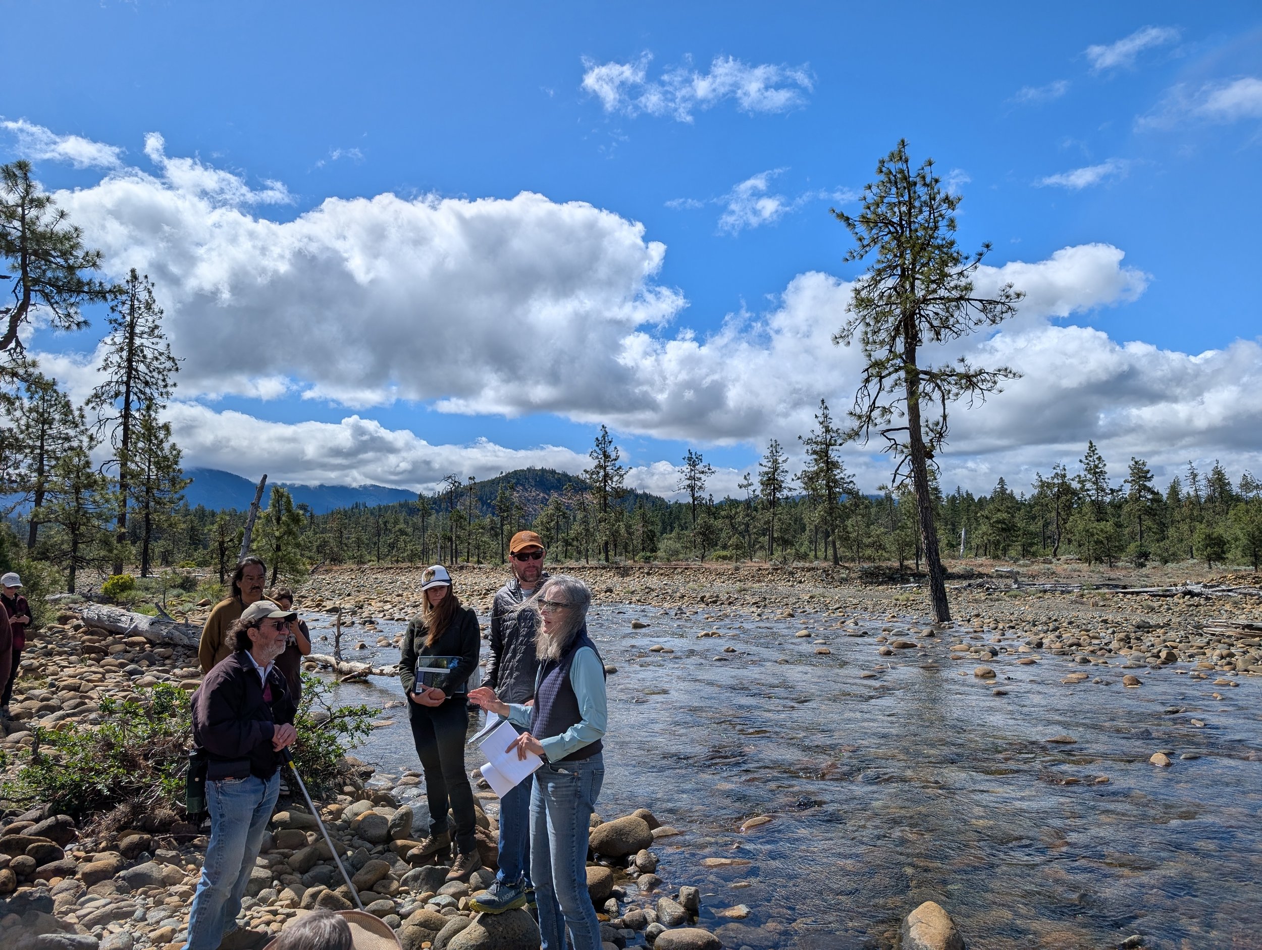
At the Rough & Ready Creek stop on our field trip, we heard from local advocates and NGOs about the unique geology and hydrology of the waterway. Rough & Ready Creek is a tributary of the West Fork Illinois River, which meets up with the East Fork Illinois River near Cave Junction. Locals take great pride in the quality of water that flows through their watershed, and it’s clear that residents and many in the business community fear what could happen with a large-scale industrial mining district situated in their backyard public lands. KS Wild business supporters like Northwest Rafting Company rely on this watershed’s clean, clear water for running Wilderness whitewater rafting trips every spring.
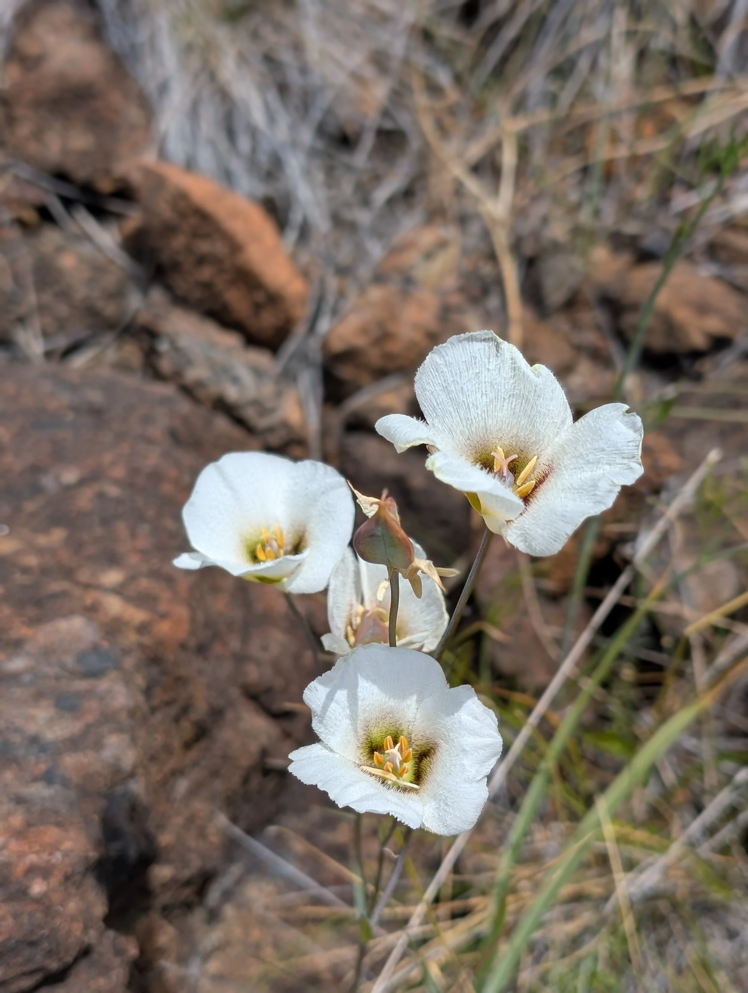
Along the TJ Howell Botanical Drive, there are several pull-outs where you can park your car and check out the Illinois River and its tributaries. There’s a road/trail across from where Josephine Creek enters the main-stem Illinois where you can hike and see the rare Howell’s Mariposa Lily blooming in late May through mid-June.
After visiting the Rough & Ready Creek Area of Critical Environmental Concern, our field group drove down-river to the main stem Illinois River where Josephine Creek comes in. From this location, you have views of the famous Green Bridge (of the Biscuit Protest days) and of Eight Dollar Mountain.
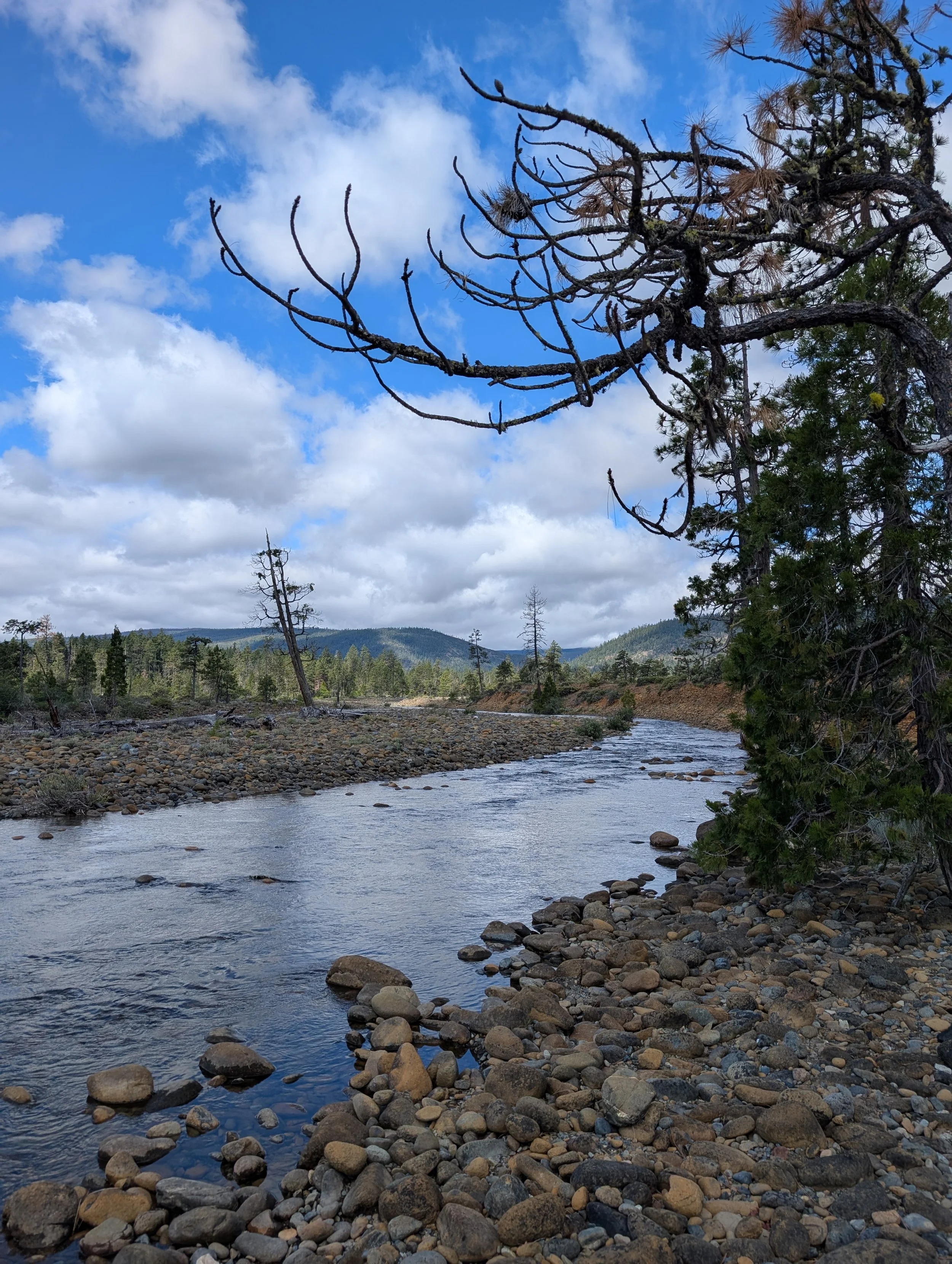
This particular area where we visited along the Illinois River is part of the US Forest Service’s TJ Howell Botanical Drive, which is a 15-mile, out-and-back driving route on paved forest service roads along Eight Dollar Mountain and Days Gulch. These places are home to unique wildflowers as well, and on a short hike near Eight Dollar Mountain, we spotted the rare Howell’s Mariposa Lily!
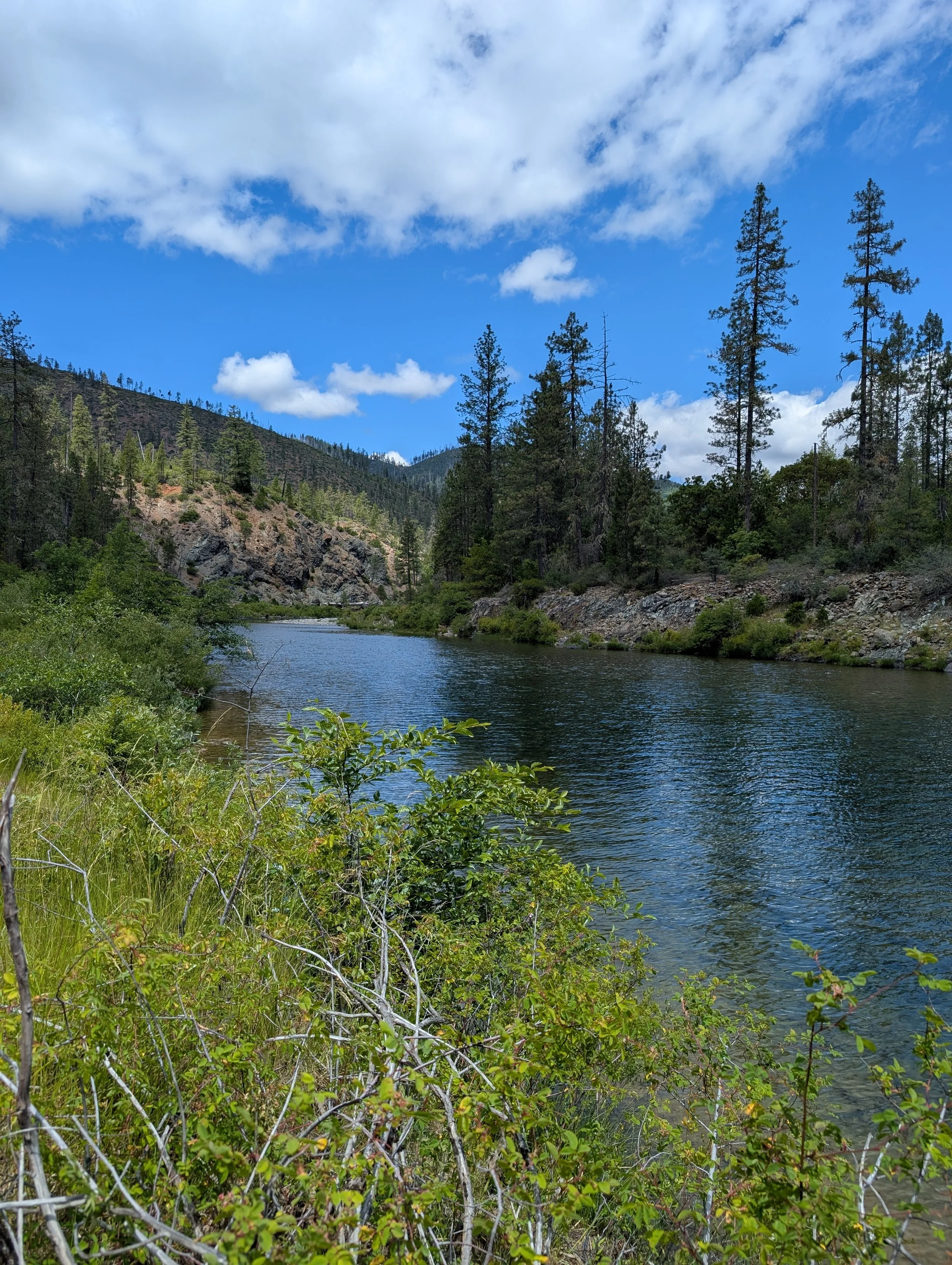
There are several day use/picnic areas, and a campground, along the TJ Howell Botanical Drive. During the warm summer months, the river’s gentle flow in these parts provide ample opportunities for swimming.
While places like Red Flat and Cleopatra Mountain in Curry County are part of a temporary mining moratorium under the 1872 Mining Law, the Illinois River watershed does not have similar short-term protections. While a 51-mile stretch of the Illinois River was designated Wild & Scenic back in 1984, the landscape around the river remains open to new mining claims which is why Homeland Nickel has had success of late gobbling up claims. Despite new efforts under Senator Wyden’s River Democracy Act to protect the Illinois River and tributaries from future mining claims, the legislation is stalled and languishing in Congress while Republicans hold power there on the Senate Environment and Natural Resource Committee. A big part of our field trip was to brainstorm organizing opportunities, while supporting each other and the local communities with ways to push back against these potentially toxic nickel mining proposals.
Locals and NGOs are activating in proactive ways, and Oregon’s Department of Environmental Quality is currently considering Outstanding Resource Water (ORW) designations for the Wild & Scenic Illinois River, as well as Rough & Ready Creek. There are only a few Outstanding Resource Water designations in the state of Oregon, and one of them happens to be adjacent to the Illinois River (and that’s the North Fork Smith River). Under the Clean Water Act, states have the authority to establish certain waterways as ORWs which prevents further degradation to the water quality. Oregon’s Department of Environmental Quality is currently in the midst of their three-year strategic plan and has listed the ORW rulemaking for the Wild & Scenic Illinois and Rough & Ready Creek as one of their top priorities. KS Wild staff are part of the Rulemaking Advisory Committee that is meeting this summer to gather input from community members, state agencies, and business interest groups to determine water quality standards that come with an ORW designation. It is our goal to establish these two waterways as ORWs by the time that Spring 2027 rolls around, and we are excited to be working with Oregon’s DEQ on proactive conservation efforts that highlight the exceptional water quality, ecological, and recreational values the Illinois River watershed is known for.
Want to learn more about other local mining threats?
Click to read about proposed mines in Curry County and on Cleopatra Mountain on the OR/CA border.