Foreign mining proposals threaten wild rivers across southern Oregon
It’s no secret that the landscape of southern Oregon is incredibly unique. From towering ancient forests to crystal-clear, rushing wild rivers to rare soil types that create a home for endemic plants—this part of the country is truly something special. But the uniqueness of southern Oregon isn’t just coveted by the human and wildlife communities that admire it for its beauty and sustenance…
Right now, a Canadian mining company named Homeland Nickel has revived claims across thousands of acres of public lands all across southern Oregon. Communities and concerned citizens around these parts have been dealing with large-scale mining proposals for several decades, but after a short lull, mining companies are emboldened by the Trump Administration’s pro-extraction policies.
KS Wild is working with partners across the region and state to push back on the mines that threaten the water quality, plant and soil health, and enjoyability of our wild rivers and public lands, but we can’t do this without you. Please take a moment to learn more about the mining threats across the watersheds of southern Oregon below, and prepare to join us in a battle for the protection of our public lands.
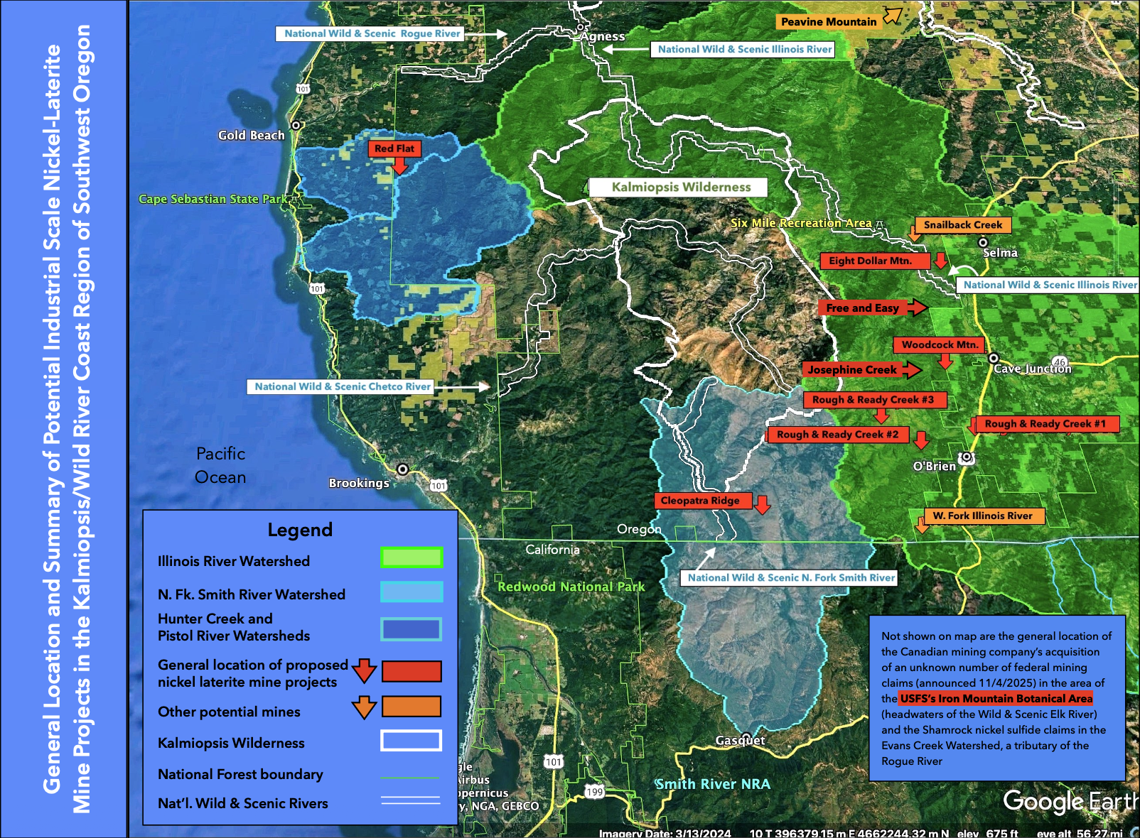
Map of proposed mining claims. Click to enlarge.
See the stats of each proposed mining site here
-
In Nov. of 2023, Homeland Nickel (hereafter HN) acquired 84 existing federal mining claims on ~1,736 acres at Red Flat from RAB Capital. The claims are within the Southwestern Oregon Mineral Withdrawal. A plan of operations (PoO) for deeper exploratory drilling is before the U. S. Forest Service (USFS). Its primary purpose is to delineate the extent of mineralization identified during a 2007-2009 drill program and determine claim validity if HN submits a PoO to develop a mine at Red Flat. The affected area is the headwaters of Hunter Creek and the N. Fk. Pistol River, which includes the Hunter Creek Bog and North Fork Hunter Creek Areas of Critical Environment Concern (ACEC) and Red Flat Botanical Area.
-
At the same time HN acquired 139 existing federal mining claims on ~ 2,780 at Cleopatra Ridge, also within the Southwestern Oregon Mineral Withdrawal. A PoO for deeper exploratory drilling is before the USFS. Its primary purpose is to delineate the extent of mineralization identified during a 2007-2009 drill program and determine claim validity if HN submits a PoO to develop a mine at Cleopatra Ridge. The claims are within the South Kalmiopsis Inventoried Roadless Area (S. Kalmiopsis IRA or IRA) and the watershed of the Wild & Scenic N. Fk. Smith River, an Outstanding Resource Waters. Due to extremely rugged terrain, the proposed drilling program is limited to existing trails.
-
There are approximately 1,200 acres existing federal mining claims in the Rough and Ready Creek Watershed within the Southwestern Oregon Mineral Withdrawal. They’re held by RNR Resources (RNR). The claims are located in S. Kalmiopsis IRA and the Rough and Ready Creek ACEC. In 2011, RNR Resources submitted a plan of operation for Rough and Ready Creek, which included construction of a smelter facility on the ACEC, two mine sites in the S. Kalmiopsis IRA and miles of haul road with numerous creek crossings. It appears RNR may have submitted a similar mining plan of operations in 2024 or 2025 but this has not been confirmed. While BLM records show RNR Resources as the claim holder, HN current website project page now lists Rough and Ready Creek as one of their projects.
-
In March 2024, HN announced the location of 115 new federal mining claims on ~ 2,376 acres of USFS land on Eight Dollar Mountain. Most of the claims are within the Eight Dollar Mountain Botanical Area immediately above the National Wild & Scenic Illinois River. Popular recreation areas, campgrounds, trails and trailheads are found along the river up- and downstream of the mining claims. Also found on Eight Dollar Mountain are an ACEC, Oregon State Park property, two private rare plant preserves, private residences and the Siskiyou Field Institute.
-
In August 2025, HN reported acquiring 196 new federal mining claims on 4,050 acres at Woodcock Mountain. Most lie within the S. Kalmiopsis IRA and Josephine Creek Watershed (a tributary of the Wild & Scenic Illinois River). Most of the claims are on USFS land with additional claims on public lands managed by the BLM. On Nov. 4, 2025, HN also reported the purchase of an additional 350 acres of claims at Woodcock Mountain from RNR Resources who also holds the Rough and Ready Creek claims.
-
On Nov. 4, 2025, HN reported the location of 174 new federal mining claims on 3,595 acres in the Josephine Creek Watershed and S. Kalmiopsis IRA. Sampling was conducted in the summer of 2025. A PoO for surface sampling and auguring in 2026 will be submitted soon. Josephine Creek is a tributary of the National Wild & Scenic Illinois River (entering at mile 1.7). The watershed is home to the highest concentration of Serpentine Darlingtonia Fens in the world.
Take action to protect our wild rivers from foreign mining interests!
Sign the petition
We’re requesting agency transparency & opposing foreign corporations' activities that would pollute our lands, fisheries, & drinking water sources.
Participate in the 100 Words Project
We’re inviting you to tell your story. What do your public lands mean to you? Tell us in a few sentences to be featured in local media and in our zine!
Read our field reports here
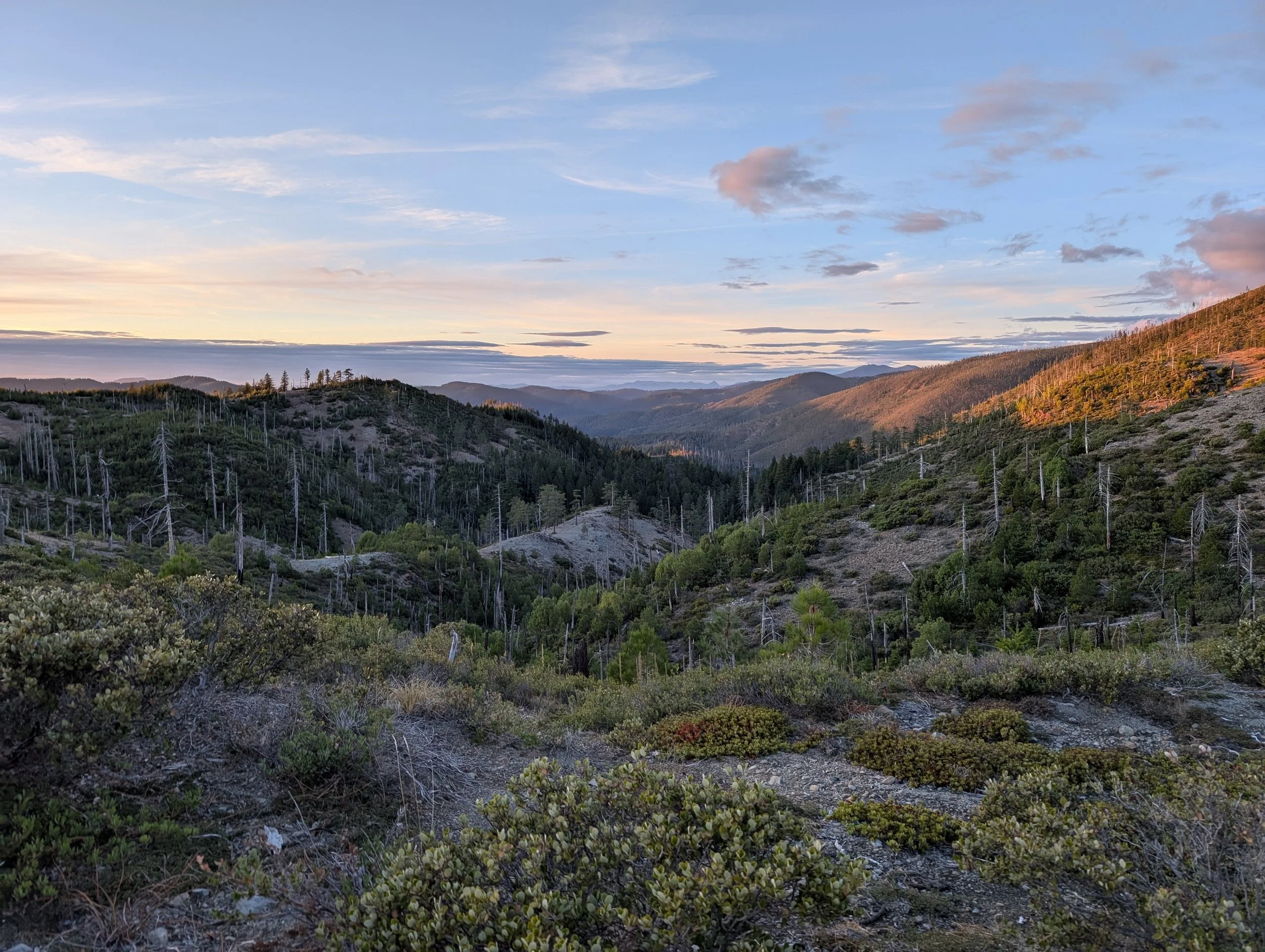
Cleopatra Mountain & the North Fork Smith River Watershed: A wonderland of geology & botany
📍 139 mining claims across 2,872 acres outside of Selma, OR
Cleopatra Mountain is home to stunning views, rare plants, and a fight to keep one of Oregon’s wildest watersheds free from mining.

Eight Dollar Mountain and its botanical rarity under threat by homeland nickel’s mining proposal
📍 115 mining claims across 2,376 acres outside of Selma, OR
Eight Dollar Mountain is known for its unique geological formations, rare plant species that rely on its unique soils to survive, stretches of the mighty Illinois River, and thousands of acres of public lands to explore.
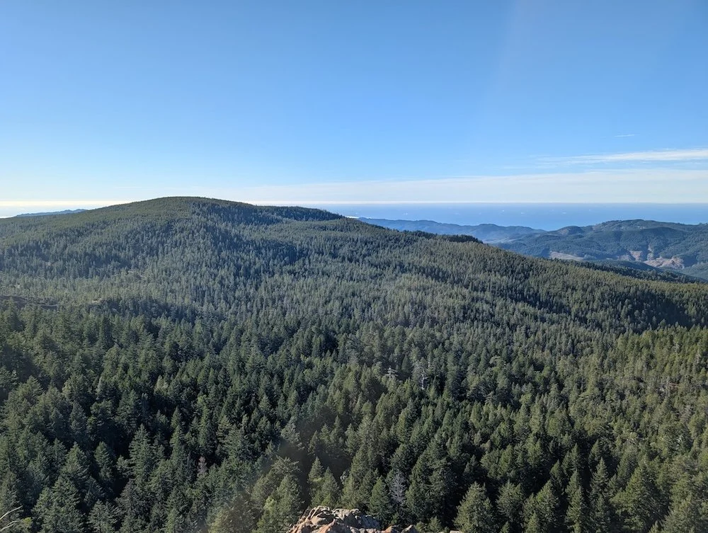
Red flat proposed nickel mine threatens southern Oregon’s coastal mountains & communities
📍 84 mining claims across 2,015 acres outside of Gold Beach, OR
Dive into our latest field report from Red Flat—headwaters to Pistol River and Hunter Creek, and new target for Canadian mining company, Homeland Nickel.

Rough and Ready Creek’s unique landscape threatened by Homeland Nickel’s mining exploration
📍 1,200 acres of existing federal mining claims outside of Selma, OR
The biological wealth of Rough and Ready Creek allows for unique plant species to thrive — some here and nowhere else on earth. Read more about our recent field tour to learn about Homeland Nickel’s mining exploration here.
Take Action!
Join us in mobilizing for our wild rivers & their unique watersheds.
Sign our petition to request agency transparency & oppose foreign corporations' activities that would pollute our lands, fisheries, & drinking water sources.
In the news